Translate

Monday, July 1, 2013

From Cobbs Arm to Codjack Cove


Monday, day two, of our circumnavigation of New World Island dawned bright and sunny.  We were underway at 7:30 and preparing to head north.


As we crossed Cobbs Arm we had a southwest wind blowing out of the Arm on the port beam.  Somewhere while crossing Cobb Arm my watch became detached from my PFD and is now on the bottom.  I felt somewhat lost without it for I was navigating with it in conjunction with the topos and compass.


The Arm is only one km wide and we were in relative calm again.  Small islands danced on the horizon in the bright sunlight.


An hour after breaking camp in Cobbs Arm we turned into Pikes Arm and again the southwest wind.  The short fetch meant we only had the wind without the wind waves.


At the end of Pikes Arm, at Herring Neck, we came to the bridge that let us out of the Arm and into Toogood Arm.


The bridge at Herring Neck rests on early Silurian age (~ 440 million years ago) conglomerates.  These sediments were deposited into a basin during the closing stages of continental collision when the continents of Laurentia and Gondwana came together to close the ancient Iapetus Ocean (Proto-Atlantic).

The conglomerate is poorly sorted with some huge boulders included, suggesting a slump of material into deeper waters after accumulation near shore.

I paused to take pictures and reflect on the enormous different in time between me and the conglomerate formation.


At Sunnyside, coming up on the left, and Ship Island, on the right, we would make a sharp left hand turn to get into Gut Arm.  I found this area picturesque with traditional fishing stages propped up on stilts at the water's edge.  Its as Newfoundland as Newfoundland gets.


After picking our way through the maze of Arms and islands we paddled through Gut Tickle and ...


... into more open waters and rocks formed by the Twillingate granites.  After a brief stop we set out westwards to cross the 3 kms to Little Harbour Bight where we planned to camp for the night.

The wind the next day would be blowing right into the bight so despite paddling 20 kms we had a change of plan.  We paddled across the mouth of the Bight, around Gunning Head and into ...


... Codjack Cove just after noon where we had lunch and filtered some water.  It was going to be a longer day than anticipated but a wise decision nonetheless.

Here are the breadsrumbs for the morning's paddle from Cobbs Arm.


Sunday, June 30, 2013

Day one ends at Cobbs Arm


After a lunch and a bit of just lazing about in the warm sun we set off again along the coast of New Word Island between Ninepin Arm and Milliners Arm.  Still the coast did not excite but the paddling was glorious.


We passed by Milliners Arm only looking in as we went by.  We were making good time and it wasn't long before we were in sight of Jack's Island to the north.  We chose to duck inside of an unnamed island to the southwest, through this channel that led into Cobbs Arm.


Looking back through the channel.


Ten minutes later we landed on a beach at the end of a small cove off of Cobbs Arm.  Kate Hartland and company stayed at this location in their 2012 trip of which her report served as a useful reference guide.

After landing on the beach I walked up a short grassy bank to survey the area for camping.  It was perfect with lots of room for any number of tents.  As I turned to tell the gang the good news I had a wonderful view out over the Arm.


We set up the tents.


At the beach Brian had set up a bar and served refreshing gin and tonics with slices of lime.  It was a delicious and unexpected treat we savoured in the shade on the far side of the cove.  Those unexpected treats are the best.


After eating supper we had our traditional camp fire.  Wood was collected and a fire started.  As the tide began to rise the fire migrated up the beach keeping out of the reach of the sea.  The smoke was a welcome relief as it kept the mosquitoes away.


We shared laughs into the night, and drinks.  The fire grew.  It was a placid scene looking out over the yellow flames and the still waters of the cove beyond.  Before long all that was left of the fire were ...


... ashes.

It was a satisfying first day on our circumnavigtion.  We had come 25 kms effortlessly from our put-in.  Here are the ...


... breadcrumbs.  Click here to open a new page of a Google image of where we were relative to the everything else.

Also, check out fellow adventurer and blogger Dean on his blog.

New World Island - relative to, everything


It occurred to me that it might be a good idea to provide a reference for where New World Island and Twillingte Islands are relative to everything else.  Otherwise, the trip is just a paddle along a differently named coast.

Saturday, June 29, 2013

New World Island, the journey begins


Almost the minute our circumnavigation of Merasheen Island was completed in 2012 I've been looking forward to this years great adventure.  Over the winter we settled on a circumnavigation of the group of New World Island, North and South Twillingate Islands in Notre Dame Bay.

At 8:00 on Saturday, June 22nd, Hazen picked me up and we were on our way to meet Brian, Dean and Neville for the drive out.  The plan was to camp at Dildo Run Provincial Park Saturday night and leave Sunday morning.


After checking in we drove round a bit to scout part of our route, had a not-so-great supper of fish and chips (which really surprised us) before returning to our campsite.  Some of us tried to get a jump on loading the kayaks.  Eventually we got a bag of firewood for an evening campfire and once that was burned up we retired for the night in anticipation of the morning's start to our 2013 adventure.


Our campsite was just off of the water where we finished loading our kayaks and just after 8:30 we were ...


... on our way under a bronze sun reflecting off of little rippled water of Dildo Run.


The Run is pock-marked by small islands to our right.  The land to our left was nondescript and lay low.  I didn't care, I knew more spectacular scenery awaited.


Close to 12:00 we began to look for a place where we could take out for lunch.


Each of us set up on the thinly bedded rocks that had been tipped up on edge by the tectonic forces of continental collision.  But more on that later.  New World Island was center stage at the closing of the Iapetus Ocean during the latter part of the Ordovician.


The tide was ebbing as we had our lunch.  Every now and then lunch was interrupted to move the fully loaded kayaks out to follow the dropping water.


Brian found a comfortable place under the sun and chose to catch a few rays.  The trip was starting out in great fashion.  I felt elated to be away from the hustle and bustle of everyday life.


Friday, June 21, 2013

Gone paddling


Saturday five of us are off for our "big" kayak camp trip of the year.  The destination this year is New World Island and Twillingate islands.  I'm hoping for 150 kms depending on how much we hug the shore over 6 days.  Looking forward to getting away.

Please, check back early July.

Saturday, June 15, 2013

Faster than a speeding bullet


Today Brian, Dean and I paddled around Little Bell Island and Kellys Island like we were late for supper and in a hurry.  We left Topsail Beach and struck out across Conception Bay for Little Bell Island.  We covered the 4.5 km crossing at an average speed of 8.0 kms/hr.


Looking up Conception Bay towards Bell Island and the coast running up to Cape St. Francis the sea was flatter than flat and not a breath of wind.  I stopped to take a few pictures while the guys paddled on.  I didn't, or rather couldn't, make up the distance so I paddled on my own ...


... until I reached Little Bell Island where Brian and Dean waited ...


... in the rain that was teeming down.  With the water so calm the rain drops were bouncing like so many ping pong balls.


We were together again and paddled at a more relaxed pace across the back side of the island and ...


... eventually we were in sight of Kellys Island beyond.  Again, it was a sprint across the 2.4 km gap ...


... where we again paddled at a more relaxed pace under the dominating cliffs of alternating sandstone and siltstone layers of rock.


Further along on the backside the cliffs were more modest.


Rounding the southern end we stopped for lunch before jumping in our kayaks for the 3 km crossing to Long Pond and ...


... the less interesting shore leading back to Topsail Beach.

Four after leaving the beach at 9:30 we were back, our day paddle cut short by our speed.  We had covered 21.1 kms in a moving time of 3 hours and nine minutes for a moving average of 6.7 kms/hr.

Another 21 kms added to my log and I'm sure I'll have no trouble sleeping tonight.


The breadcrumbs we left in our wake.

Friday, June 14, 2013

Weather for ducks


Yesterday evening Dean and I were the only participants at our Thursday evening get-togethers.  It was cold (5C), wet and windy out of the northeast but I knew I could count on Dean.  We were undeterred and put-in.  We waited until 6:00 to see if anyone else would show up.  No one did so we went for a short paddle up to Portugal Cove.


Only the third time in his new Nordkapp and Dean was paddling around the rocks.


And again, Dean paddles through Clyde's Rock.

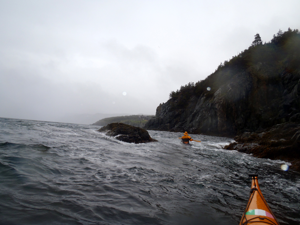
It was crappy weather for sure but there's nothing to do about the weather.  I had warm clothing on under my drysuit and I was dry.  I had no complaints.  We were about 60 minutes paddling up to the Cove but, incredulously, only 20 minutes going back to St. Philips with the wind and swell behind us.

It was weather for ducks.  Two of them.  Dean and myself.