3 days ago
Showing posts with label Iona Islands. Show all posts
Saturday, May 23, 2015
Looking for the monks of Iona - Chapter 5
Monday morning, day 3 of our Victoria Day long weekend trip, dawned sunny and bright. The forecast was for wind out of the northeast which would be in our faces for the return to civilization.
We exited the sheltered Trinny Cove and headed north into the wind. The wind whistled in my ears and the kayak ...
... slammed down as it climbed over the waves.
As we approached Red Cove Head we knew there would be an opportunity to find shelter and ...
... catch our breath.
We hopped up the coastline sheltering out of the wind where we could until we caught sight of Fairhaven Island at the entrance to Fairhaven.
Our takeout was over two kms into the distance with no protection from the wind. It became a process of looking ahead for coastal features, paddle to it and then the next objective.
My strategy is to just paddle without concentrating on the destination. I took one final picture because every time I took out the camera I fell off the back of the group and had to paddle hard to catch up. By concentrating on just paddling we eventually arrived back at the ...
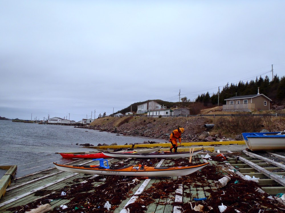
... slipway in Fairhaven. It was a bit of work for sure but we were well positioned for the forecast only 6 kms from Fairhaven. Checking my GPS afterwards showed we made a respectable average of 5 kms/hr into the wind.
We didn't find any traces of monks at Iona. Maybe we were in the wrong Iona Islands? Maybe we would have had better luck paddling in Scotland? No matter, it was an excellent three day trip and there's no harm in a bit of fantasy to make a trip interesting.
Friday, May 22, 2015
Looking for the monks of Iona - Chapter 4
After stopping for lunch and a look around Harbour Island we made a short 2.5 km crossing to the Brine Islands.
Passing Woody Island, the largest of the Brine Islands the next group of islands on our way back to the mainland were the Grassy Islands which were ...
... more rock than grassy. Maybe there was a bit of sarcasm in the naming?
Even so, they were picturesque.
The wind came up making it a bit of work to cover the six kms to Trinny Cove where we set up the tents for our second night. We arrived at Trinny Cove just after 2:30 an with lots of time I decided to go for a hike to the top of the 50 meter high hill which dominated the cove. On the way I passed ...
... evidence of the previous occupation of the location. At the base of the hill the outlines of vegetable beds could still be seen.
Trinny Cove is one of the hundreds of Newfoundland communities that were abandoned and resettled to larger centers where better services could be provided. Records do not indicate when Trinny Cove was settled but the census in 1836 recorded 19 persons. Between 1845 and 1884 the place was abandoned and reoccupied from about 1884 until 1921 when it was permanently abandoned.
In all those years the maximum population never exceeded 30.
At the top of the hill I had a great view looking northwest at the Trinny Cove Islands and the top of Long Island n the farthest distance and a grand overview of ...
... our campsite. We were camped in the middle ground. Access to the lagoon behind the barasway was denied by the low tide and, besides, the camping ground there was too exposed to the wind.
By the time I got back it was time to get supper on the go. Where we had pitched the tents was moderately protected from the wind but wind protection for cooking was required. I used this washed up fish tub to place the stove.
As the sun began to set the chill from the northeast wind became noticeable. There was plenty of wood right at hand which made a campfire easy work. Once we had the fire going we opened the bar.
Darkness fell, it got colder, we crept closer to the fire for warmth. The fire got bigger. With all our wood on the fire we let it burn down until all that was left were ...
... glowing embers that looked like so many stars scattered in the night sky.
I picked up the rock I warmed near the fire, carried it to my tent to put it in the bottom of my sleeping bag and drifted off to sleep with, at least, warm feet.
It was a most enjoyable second day out.
Thursday, May 21, 2015
Looking for the monks of Iona - Chapter 3
After a chilly night's sleep where the temperature went down into the low single digits and a breakfast of stick to your ribs porridge, we got ready to paddle out to the Iona Islands.
We struck out for the three km crossing to Merchant Island from Long Harbour Head under clear sunny skies and just a light breeze.
Approaching Merchant Island on the left with Hole in the Wall Island just over Terry.
Merchant Island is almost two kms long. When we reached its northern end we got out to check out this grassy area for a possible campsite. From the raised area we had a fine view of ...
... Burke Island and Long Harbour beyond.
Our net destination was Burke Island where Terry, resting, said the community of Iona stood as in ...
... right here. OK, I've misled everyone. These were the Iona Islands of Newfoundland and not Scotland where St. Columba founded his monastery. Many places in Newfoundland bear names from the old counties of Ireland, Scotland and England. Its easy to get confused *lol*.
Anywho, Iona had a booming population of 197 in 1838 which held relatively stable until between 1921 and 1935 when the population dropped to 67. The community was dominated by families of Murphy, Griffin and Duke. No one lives there anymore as the community was resettled to the mainland in the 1960's.
Terry got out to investigate while the rest of us waited. Merchant Island on the left and King Island further in the distance in the center.
It was getting near lunch time when we crossed the short one km to Harbour Island so once we got there we ...
... got out to have something to eat. Entering the protected cove we spotted two nesting Canada geese so we came ashore in these kelp covered rocks well away so as not to disturb the rare, for Newfoundland, birds.
A community at Harbour Island first appeared in the census of 1911 when 57 persons were listed. This community is also abandoned. It appears its only used now to graze sheep while the ...
... scattered, fallen tombstones look on.
Friday, April 10, 2009
Theory of go for it
Route of our paddle to the Iona IslandsThis past week Stan came down with a stomach flu and only started to feel better yesterday. We spoke this morning and decided on a paddle to the Iona Islands in Placentia Bay, Newfoundland. We put-in in Mount Arlington Heights.
The Town of Long Harbour - Mount Arlington Heights had a population of 211 in the 2006 census. It was the former site of the Albright Wilson phosphorus plant. Things are looking up thought as a new hydrometalurgical plant to process Voisey's Bay nickel is scheduled to begin construction shortly. This should boost the population.
Anyway, back to the paddle. We took our time as Stan wasn't feeling on top of his game. We weren't in a hurry as we had no wind and just a gentle swell at times. At times we stopped in the middle of the bay, drifted and listened to the sounds of silence. After stopping for lunch and snapping some pictures we paddled back to the put-in and saw a couple of minke whales.
Sometimes ya just have to go for it. We paddled about 20 kms, you're a trooper Stan! Pictures hereunder.
Tony :-)
Subscribe to:
Posts (Atom)


