Translate

Showing posts with label Bell Island. Show all posts

Monday, October 21, 2019

Paddling in the lun


Sunday the forecast was windy; 17 knots west gusting to 23 knots.  We are blessed with outstanding ocean scenery but cursed by topography.  The prevailing winds are SW and W and with many of the bays facing east, it leaves few options.  One I considered was a paddle along the east side of Bell Island.  So, Sunday Jenn and I caught the 12:10 ferry to Bell Island from Portugal Cove. A short ride to the nearby beach and we were at the put in.


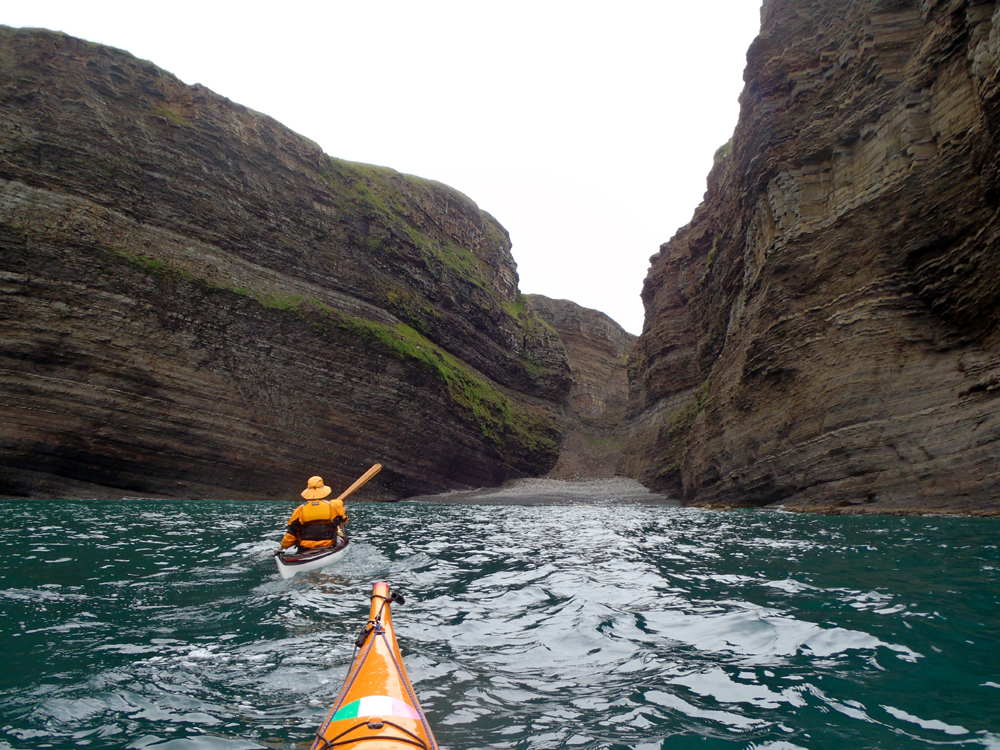
"Lun" is Newfoundland vocabulary for a quiet protected place.  It was where we were in the wind shadow under cliffs rising 75 - 100 meters above the sea here approaching Green Head.


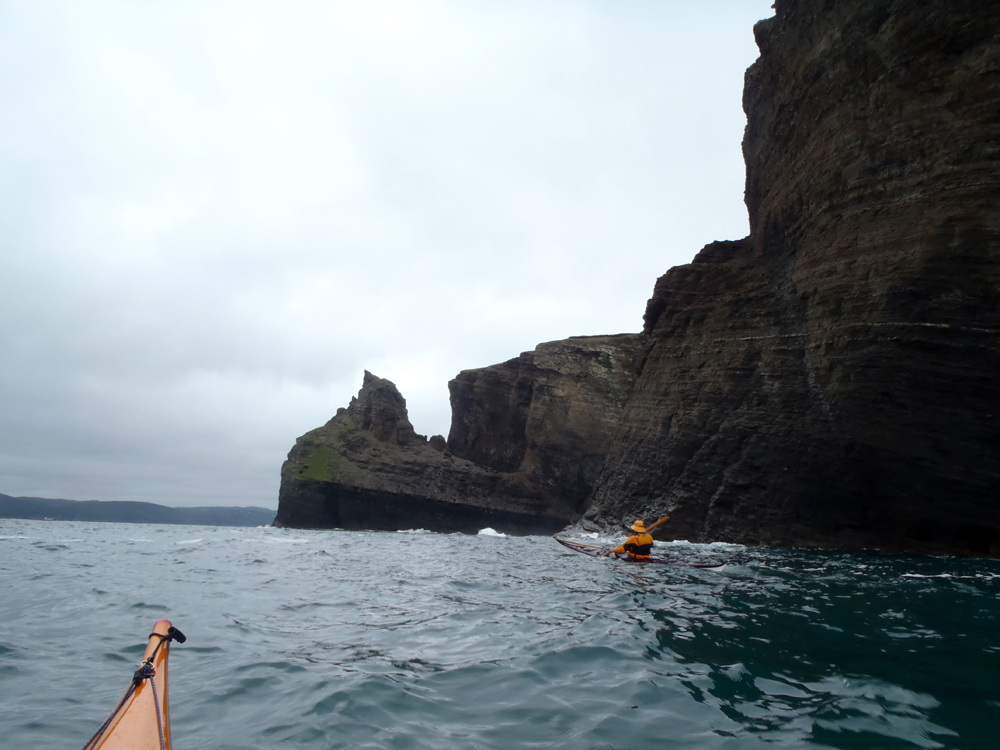
Water trickled down in places; we passed by the one sea stack as we paddled northerly.


The distinctive cliffs at Long Harry.


Passing Polls Head we entered the wide sweeping cove with a good example of the structural geology of Bell Island.  Here a wide bed of brownish grey sandstone interbedded with darker shales shows the beds strike northerly and dip easterly.  That is to say, they slant from left to right and dip away from us.


Near Eastern Head we looked through this tunnel into a cove on the other side of the teardrop peninsula.  Jenn and I paddled a bit further past Eastern Head to stick out our noses where we felt the strength of the wind.  We decided to turn around here and ...


... head back in a southerly direction.  We passed by the beach where we put in as there was more protected coast to explore.  Here we were at Dominion Pier, one of two iron ore offloading locations.  Continuing on we reached the nearby ...


... Scotia Pier.  The oolitic hematite was first recognized as iron ore around 1892 though ships used the ore for ballast for the return voyage to Europe for decades.  The Nova Scotia Steel and Coal Company acquired mining rights shorty after 1892 and Dominion Iron and Steel Company in 1899.

The iron ore beds dip east with underground mining running some 3 kilometers offshore and 500 meters below sea level.  The mines produced 48 million long tons of ore before being closed down in the late '60s .  Estimates of 10 billion, yes, that is with a capital B, tons remain, however, the cheaper cost of surface mining at other locations makes it uneconomical to mine.


We carried on some more with an eye on the clock and the arrival times of the ferry for the return.  Here passing a waterfall and ...
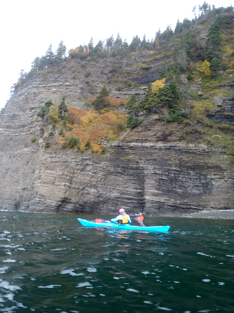

... the ever present trees clinging somehow to the cliff faces, some in fall colours.

We agreed to paddle on another 15 minutes which put us close to Lance Cove where we turned around to catch the 5:30 ferry back to Portugal Cove.  I failed to conscript any of my paddling buddies but Jenn and I made the most of a questionable paddling day.  We were well protected from the wind which we did feel from time to time but nothing to cause us any difficulty.

Jenn is a visiting artist-in-residence from Nova Scotia.  We've managed four paddles in the six weeks before she leaves next weekend.  If this is the last paddle we do, I think it was a nice way to cap off her Newfoundland visit.

Monday, July 4, 2016

One night on Kellys Island (Part 1)


We've been to Kellys Island in Conception Bay numerous times.  We checked it out for possible campsites and threatened to camp there.  Its close by and ideal for a one night kayak camp trip.

Friday Cathy and Gary hatched a plan to bring that one night trip to fruition.  I wasn't sure about the timing as my "To Do" list was extensive but I decided I needed to cross that trip off my list.  We met at Long Pond at 9:30 to load up the kayaks for the 4 km crossing.


Leaving Long Pond we headed straight for the cobble beach where we would decide to either camp on the beach or on the hill 15 meters above the beach.  We climbed the steep hill and selected a site for our tents.  The plan was to set up the tents first, have lunch and then ...


go for a paddle.


On the northwest side of the island we set off for Bell Island.  We took turns predicting the distance to a beach.  Cathy had it at 4.2 kms, Gary 5.0 and myself at 4.7.  The GPS read ...


... 5.2 when we reached the island so Gary won that one.  But, there was no prize as we hadn't placed any bets.


The water was so clear and the sun so strong it made Cathy look like she was floating unsupported above the sea bottom.


Cathy wanted to paddle to the west side of Bell Island to the Grebes Nest so we headed west across the south side of the island under impressive cliffs reaching 50 meters in height.


At Freshwater Cove a short ladder up the hill attracted our attention.  The day wasn't all about the paddle so we landed and took a short hike up following a small stream up a ravine.  Further on we used a rope hanging down a slippery slope to climb onto ...


... a flat area with a great view down the ravine we named "Ant Hill Ravine".  We walked a short distance with the hope of finding a pond the stream ran out of but we gave up.  A subsequent review of maps and Google Earth showed the stream had no source in a pond.  Good call!


By the time we continued our paddle it was 3:00 and getting too late to make the 14 kms round trip to the Grebes Nest so we agreed to go as far as "The Bell" of Bell Island.  Here I named the two stone pillars "Homer" and "Marge".


Under crystal clear blue skies in Front Bell Cove with "The Clapper" on the right.


Cathy approaches "The Bell", a massive seastack ...


... standing off of Bell Island.  We padled through in a stiffening breeze out of the north that increased in intensity squeezed between the two land masses.  Around "The Bell" we rafted up and decided to make a bee line for Kellys Island and return to camp for happy hour and supper.

The game this time was to guess ho long it would take to cross the 6.5 kms distance.  We each had a guess which turned out to be 60 minutes but we could have shaved 10 minutes off of that if we had wanted to as we got a good push in the following wind and sea.

Sunday, July 26, 2015

Second time around the Bell in two weeks


The plan as I left home this morning was to paddle to Bauline from St. Philips and back for a total of 30 kms.  As I drove to the put-in I thought I'd suggest to Dean that we paddle around Bell Island for 35.  I had one the circumnavigation solo two weeks ago but was game to do it with Dean for his first time this year.

He said yes and we struck out across the Bell Island Tickle to Bell Island 5 kms away.


Dean loves crossings *lol*, not, so he put his head down and paddled hard to get across.  A minute and a half later I also arrived at Dominion Pier from where we headed southerly to begin our rounding


The thing that makes Bell Island such an appealing paddling destination are the massive, tall cliffs.  Here we're reaching Chimney Rock near the south end.


At Front Bell Cove we were nearly at the southern extremity of the island where we found "The Clapper".  It looks like its attached to the island from this perspective but it is a seastack which symbolically rings the ...


... "Bell" on the left.  It too is a seastack separated from the island by a channel of some 40 meters wide.  As I entered I could feel the swell running down the west side and heaving up in the shallow passage.  Committed, a wave broke right in front of my bow.  I paddled hard to get over the surging water and then paddled back otherwise I'd have been clocked by the next breaking wave.  Picking my spot I paddled safely through.


Where we had calm conditions on the easterly side paddling south, when we arrived on the westerly side the swell was running from the north directly in front of us.  The rebounding waves made for chaotic conditions.


The cliffs run northerly for 10 kms, the only interesting feature being this seastack with bands of oolitic hematite.


The swell forced us to keep off a bit making it seem like a long paddle as the cliffs marched unendingly into the distance but ...


... paddle stroke by paddle stroke we arrived at Eastern Head and near to the turn back southerly.


Four hours straight in the kayaks we were ready to stretch our legs and grab something to eat.  Long Harry Cove looked a good option.


A short lunch break saw us back on the water with 10 kms left to cover for our circumnavigation.  We exited Long Harry Cove with the distinctive Long Harry Point on the southerly side of the cove.


Great looking cliffs and rock formations and calmer water made the return to Dominion Pier a pleasure.  From there we crossed the 5 kms Tickle back to St. Philips, both of us agreeing to make the crossing at a relaxed comfortable pace.

Two weeks ago on my solo circumnavigation I paddled counterclockwise.  Today we went clockwise.  It made the scenery look different so it made a familiar area interesting anyway.

Six hours later we were back.  Coffee and a bite to eat at the restaurant topped off an excellent day.  Always fun to paddle with Dean who is always ready to paddle because he is a kayakoholic.

Monday, July 13, 2015

On a wild goose chase, the after lunch part


After paddling 21 kms to get to the south end of Bell Island I stopped for lunch.  I only ate half before deciding I'd continue my circumnavigation to Dominion Pier where I'd finish it and cross back to St Philips.

The water was clear to the bottom but not deep so I had the view of the tall cliff and occasionally the seafloor changed from sandy bottom to more interesting life.


Chimney Rock stands out from the island like a sore thumb.


The sandstones and siltstones of Bell Island are Ordovician in age (484 - 443 million years ago) and mostly lie flat dipping gently away from this view to the west.  Except here in this small cove.  Here a fault runs diagonally from center bottom to upper left.  On the right side of the fault the beds were bent down against the footwall.  The warping of the beds in the hangingwall is caused by drag folding when the beds were not quite solidified.


As I got closer to completing the loop I reached the remnants of Scotia Pier and the cliffs turned from brownish grey to a reddish stain caused by a film of hematite coating the grains of sand.

Bell Island was at one time the location for one of the largest iron ore mines on the planet.  That all ended in 1966 when the mines, located underground, were forced out of business by development of cheaper surface mines.


A short distance away was Dominion Pier, the second transshipment terminal for the iron ore.  The pilings still stand after almost 50 years.  I was fully around Bell Island at Dominion Pier and stopped to finish my lunch before making the 5 km crossing back to St Philips.  Before I got back in the kayak I had a look around and spotted ...


... this rock with its recording of ancient life.  The raised surfaces are worm castings that have been preserved for hundreds of millions of years.  It makes me feel small to think more than 400 million years ago worms dug through these sediments.

Back to the present.  Once in my boat again I pointed the bow to the ...


... distant shore from whence I came 5 and a half hours ago.

This was my second solo circumnavigation of Bell Island.  Its a liberating feeling especially on the west side of the island for if anything goes wrong there one is left to one's own devices as there is no one looking out over that water.

I was disappointed there was no iceberg but I was contented taking the kayak out of the water.

Sunday, July 12, 2015

On a wild goose chase, the before lunch part


Someone I know informed me he saw a huge iceberg on the other, northwest, side of Bell Island when flying over this past week.  Some guys went on the club camping trip.  The others did not express an interest in checking it out.  So, I went by myself.  I passed through the Pillars of Hercules to start my 5 km crossing to the island.


Its 5 kms across.  I like crossings because halfway is always in the middle of nowhere.


Forty minutes later I was across and arrived at Dominion Pier.  I was going to look for the iceberg but I was also doing a circumnavigation of the island.  I'd come back to this point before returning to St. Philips.


I turned north and paddled under the massive cliffs of siltstone and sandstone.


I arrived at the distinctive feature at Long Harry Point.  I was close to reaching the other side and I wondered what I would find.


No iceberg yet to see at Eastern Head.


After I came out of Number Two Cove I had a good view down most of the length of Bell Island.  Nothing.  Again, it was a two mission paddle so I carried on with my circumnavigation hoping the berg may have drifted down to the south end of the island.


Between Gravel Point and Big Cove an attempt was made to mine iron ore at sea level.  The dark spots in the cliffs are cavities where the ore has been extracted.  The lighting wasn't great.


The same sequence of rocks are exposed in this sea stack.  At the bottom just above the flat slope a bed of iron ore about 1 meter thick is exposed.


At the southwest side I reached "The Bell".  The was no iceberg on the westerly side of Bell Island.  I crossed my fingers and padded ...


... through the opening and ...


... emerged with the view south.  Off in the distance towards Holyrood was one berg but I needed the Hubble Telescope to get a good view.  It looked small so far away.  Maybe a project for another day?


With "The Bell" on my right and under "The Clapper" in Front Bell Cove I stopped at 12:30 for lunch, 20.5 kms into my 35 km circumnavigation.  I was disappointed with not finding an iceberg close by but I was feeling good about the second part of the day's mission.