Translate

Friday, July 30, 2010

Reunion

Mirror image

I've heard the tragic story before, identical twins separated at birth to be adopted by different families. Neither aware of the other and leading almost identical lives with similar interests. A chance meeting and two lives converged again, feeling they've been made whole again.

Not so dramatic last evening but I was pleased to see Malcolm pull up with his similarly coloured Nordkapp. We were at St. Philips along with 5 others to play in the wind and waves on a beautiful summer evening. Its a regular happening Thursday evenings, practicing in the conditions as we find them. Sometimes its calm but last evening we had 20 knot winds with wind waves on average 1 metre.

I paddled boxes: beat into the waves, turn 90 and paddle in the beam sea, turn 90 and ride the following sea, turn another 90 and repeat.

Some excellent surf rides, a small recompense for the work of paddling upwind. It sure is an exhilarating feeling when the wave is caught just right and the kayak shoots ahead on the face of the wave like being shot out of a cannon.

Echo

And so, the twins would be separated again to lead their own lives but satisfied with a great evening of playing in the wind and waves.

Tuesday, July 27, 2010

Seat belts: They are for everyone

Kayak safety day

When you buy a car you get an "Owner Manual" with it. It provides information on features, service, maintenance and even driving the vehicle. For example, and I quote: "This part of the manual tells you how to use safety belts properly. It also tells you some things you should not do with safety belts."

What do you get when you buy a sea kayak? Yup - nothing. Nothing to inform the novice kayaker about what safety gear is required by the regulatory authority, nothing to direct the novice kayaker to skills that must be acquired, nothing to warn the novice kayaker about some of the dangers such as hypothermia.

Mind boggling isn't it? And then we shake our heads when we hear of kayak mishaps when they are broadcast by the media.

Kayak Newfoundland and Labrador is holding a kayak safety day today. With some luck we'll address some of the information gaps novice paddlers begin with. But it shouldn't fall to kayak clubs, should it?

Saturday, July 24, 2010

Mocha Java

All the comforts of home

Just because the kayak trekker leaves home to go on kayak camping trips doesn't mean there's a need to rough it. OK, so the queen size bed can't come along but the trip can be made plenty comfortable. It all depends on personal tolerances.

The roof overhead may not be substantial yet it keeps me dry and out of the wind. I have an old style air mattress that blows up to 3 inches thick. Snuggled up in the sleeping bag I'm as comfortable as I am at home.

Cooking on a one burner stove is a challenge in comparison to the four burner stove but doesn't the food taste better when cooked in the great out-of-doors?

The culinary treat for me on our south coast trip came the evening we stayed at Wreck Island. I boiled the kettle to have hot chocolate. Ralph had instant coffee. I suggested I'd give him some hot chocolate mix for a pack of coffee. Voila, we both had a mocha java. Yes, without the cream but still a fine treat so far away from Starbucks or Tim Hortons.

Thursday, July 22, 2010

Marine forecast

Sun is not in the forecast

We listened intently on the morning we were hoping to get our paddle underway in Harbour le Cou. The marine forecast has to be short and concise, therefore its important to listen carefully and know what information the service provides.

The first bit of information given is the "marine synopsis". It gives the broad weather picture and where the major weather systems are and are moving. The mariner must keep this in mind when interpreting the forecast for the local marine area.

The actual weather is given only if it is expected to reduce visibility. Don't expect to hear if the sun will be splitting the rocks. No weather announcement in this case is good news. Rain and fog forecasts will be given as they affect visibility.

Wind is given in knots and only on 8 points of the compass.

Sea state is given but only for deep water defined as 50 metres or deeper. Knowing the local sub-sea topography is important in evaluating this bit of info. A 1 or 2 metre wave in deep water will kick up considerably in shallow water once it arrives. Curiously, the direction of swell isn't given.

Small craft warning are given when winds are forecast to be 20 - 33 knots or higher.

That's what we get from the Canadian service. I don't know if there are universal conventions for distribution of marine forecasts but best to know exactly what is provided locally before getting on the water.

Tuesday, July 20, 2010

Making a successful trip

The 3 amigos: Stan, Ralph and myself (l-r)

What makes a trip a success - other than the safe completion, that is?

Whenever three people, as in our case, set out on a multiple day trip there are always different expectations on what the trip will entail. There will be general agreement on things like departure and completion locations. There can be issues on the detail in between.

I'm reminded of a Stones song "You can't always get what you want". So it goes with kayak tripping. I'm sure neither Ralph, Stan or myself got everything on our trip that we wanted. If one of us got exactly what we wanted out of the trip, then the others would of necessity be short changed.

Its a game of give and take. It won't always work out even. If each gets some of their agenda then that for me makes a trip a success.

The same Stones song goes: "... but if you try sometime, you just might find, you get what you need." How true!

Saturday, July 17, 2010

A lesson learned

Loading up the kayaks

On our ferry ride from Burgeo to Rose Blanche that started on Tuesday we carried our loaded boats on at Burgeo, off at Grand Bruit. Back on again Wednesday at Grand Bruit and off at Rose Blanche. Then on and off a truck which took us to Harbour le Cou.

The boats weighted a ton. The gangplank onto the ferry Marine Eagle had a high handrail and its awkward position meant the boats had to be lifted high to get clearance. At some point I either tore or sprained both my right bicep and front deltoid muscles. I just moved the wrong way or too suddenly.

I didn't feel it at the start of day 1 but 26 kms paddling brought it to the fore. Starting on the second paddle day it meant Advil to relieve the pain. No sweat, I'd done that before to get a gimpy hip through a 10 mile road race. At least I'd get through the trip.

My Dad would have called carrying the loaded boats a "lazy man's load". That is, making one carry rather than making a few trips. I think the next time I'll only put the light stuff in the boat and carry the rest in bags.

Friday, July 16, 2010

Tricky takeout

On a perch

On our first day trip to Red Island near Burgeo it was time for a break. We spotted a beach on Red Island and decided to take out there. I approached but it looked tricky to take out. I like to have options when there aren't easy take-outs, especially for pee breaks, so I got out and lifted the boat up onto a flat rock above the reach of the swell. I looked out and Ralph was on his way in to advise we weren't stopping here after all.

No matter, it was a useful stop for me anyway as I cut back the foam shims in my hips pads that were causing me grief.

A nice sandy beach isn't always an option so I like to try these more challenging takeouts. With practice they get easier.

Wednesday, July 14, 2010

Grand Bruit

Entering Grand Bruit

Ralph, Stan and I undertook a sea kayak trip from Harbour le Cou to Burgeo. It was part kayak trip and part living history.

I've been in a number of resettled communities but always many years after when the building had already crumbled and all that was left were foundations. Grand Bruit (pronounced "Brit") is the latest Newfoundland community to be resettled and this time I was on hand for the funeral.

While the residents voted to resettle, it did feel like a funeral to me and I felt in a way that I was intruding.

Landmarks

Grand Bruit has two landmarks: the church which overlooks everything in the community and the falls. If a third had to be picked, it would be how the houses are all crammed together around the harbour, so typical of Newfoundland outports.

In those houses people raised families, had dreams and shared sorrows. In those houses lived people who knew each other more than as friends but as extended family. People who worked and pulled together to make a living in an isolated setting.

End of town

Looking east from the top of the falls the houses peter out. Near the center the closest green building is the oldest house at about 150 years old.

A working community

Lobster pots on this slipway attest to the fact that Grand Bruit was a working fishing community right up to resettlement. Some fishermen intend to carry on fishing out of other ports. Some will return here every summer during the lucrative lobster season because, while the residents have left, the lobster have not been resettled.

Quaint

Grand Bruit has been in the news recently over its resettlement but before that it was just another isolated community along the Newfoundland coast. It was just another name on the map and most, I suspect, never gave it a second thought.

Now that the community is dying, the province mourns the loss of yet another piece of its heritage. It was inevitable. The last students graduated from the elementary school in 2007 after which it was closed for good. The lifeblood of the community, its youth, began to drain away and its fate was sealed.

Connections

The community was connected by a concrete walkway that was wide enough for all terrain vehicles (ATV). While we were there the ATVs were busy carting household belongings from the homes to a storage building at the dock. There they waited to be shipped out on the local ferry service, bound for points west to Port aux Basques or east to Burgeo.

Along these walkways residents stopped to talk to each other. In the big city people look at the sidewalk rather than risk making eye contact with the oncoming. Here, doors did not have to be locked at night. People were connected not just by walkways, they shared a deeper connection.

Sentinels

The community is gone and all that's left are the buildings, the memories and the dead.

In maybe 50 years some other kayaker may happen upon this resettled community when all that's left are the concrete walkways and foundations and this cemetery. They may wonder about the people who lived here and what it was like to leave. I won't have to as I was here when the lights went out.

It unfortunately won't be the last time the lights get turned off. We should all share a sense of loss each time it happens.

Tuesday, July 13, 2010

Back to Burgeo

The final leg begins

We broke camp at a reasonable hour and began the final leg of our trip back to Burgeo. The winds were calm but there was a little swell. The swell didn't cause us any concern here but there was a thrill ride in our future.

Ralph calculated the paddle into Burgeo was 15 kms. A day hop - maybe!

The Nuddick

Leaving Wreck Island where we camped we paddled along between the mainland and Baring Island, Green Island and Seal Rocks. As I approached Seal Rocks it became obvious how it got its name. I could hear the grunting and other sounds seals make as they left the rocks and entered the water. They had seen us first so there went a picture op.

The water got bigger

We continued on towards Kelpy Cove Point all the while the swell was building to 2 metres until we reached Barasway Point. The ride of the trip. The swell kicked up to 3 metres and with the clapotis it got very bumpy as we rounded the point inside of 100 metres. The Nordkapp again proved its worth with a rock steady solid performance.

After Ralph and I rafted up to pump out the water in his cockpit Barasway Bay opened up in front of us like a broad grin. At the bottom of the bay a huge sandbar swept around as in the shape of a crescent moon. The swell still present propelled us along at 5 knots as we swung through the bay.

Sheltered cove

Time for a break and a good thing too. Somehow in the rough and tumble of getting around Barasway Point my water bottle wasn't completely capped and I had lost all my water. I was bone dry thirsty. I had about a cup of drinking water left in the day hatch and that would have to do until I got back to Burgeo.

The last section

We came out of Barasway Bay at Fox Point to the left with the islands of Burgeo just visible on the horizon. A kick to port and we were back at Sandbanks Provincial Park and within hailing distance of the finish.

Returning to Sandbanks

We had stopped at Sandbanks Provincial Park for a break almost a week ago when we paddled around the Burgeo Islands. Now, we were cruising past the same spot 6 days later. I reflected that it was hard to believe it was such a short time ago because so much had happened in the intervening time.

Back to the start

We paddled back to the Burgeo Haven B & B where we decided to stay for the night before driving home the next day. It gave us a chance to wash off our gear, give ourselves a good scrub in the shower and rest for the 900 km drive home the next day.

We started the final leg of our trip thinking we only had 15 kms to complete. Somehow the sums didn't add up because upon arrival at Burgeo the GPS said 25 kms. The total for the return from Harbour le Cou in four days was 109 kms.

A great adventure and a great paddle.

The first thing I did after getting out of my paddling garb? A double dip of chocolate ice cream at Joy's Place diner and a cold root beer. A great way to top off the trip.

Monday, July 12, 2010

Grand Bruit to Wreck Island

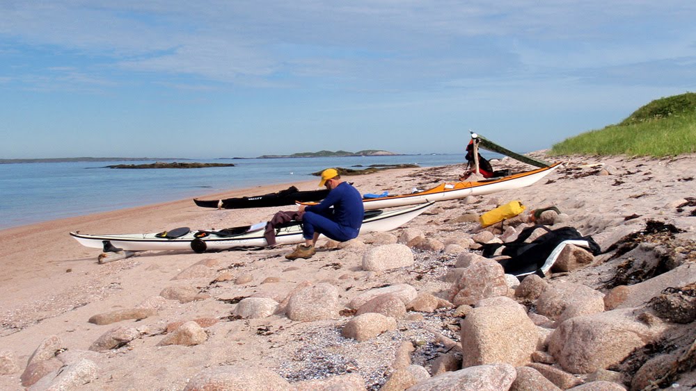
Stan ready to go - day 3

We slept in the church in the resettled community of Grand Bruit the previous night. At rise and shine we knew we had the weather with us again. A quick breakfast of porridge, kayaks repacked and we were on our way back to Burgeo. We would go far on this day.

Good-bye Grand Bruit

We had spent a considerable amount of time in Grand Bruit having to stop overnight to catch the ferry down to Rose Blanche and then again overnight on our paddle back up the coast. I got used to the place and had a number of enjoyable exchanges with the few people who were tying up loose ends before leaving the resettled community.

Grand Bruit will be left to decay like so many other resettled communities in Newfoundland. I've been in a few where the houses had fallen down and where only foundations remained. I wondered if I'd live long enough to come back one day to see only foundations - probably not.

Blue Hills of Grand Bruit

Leaving Grand Bruit the Blue Hills of Grand Bruit loomed over us in the distance. We originally planned a day hike but that may have been a bit optimistic but I'm sure the view from the top of there 400 metre high hills would have been impressive.

The water was calm and it felt like we literally flew over the surface as we made our way towards Sandbank Point.

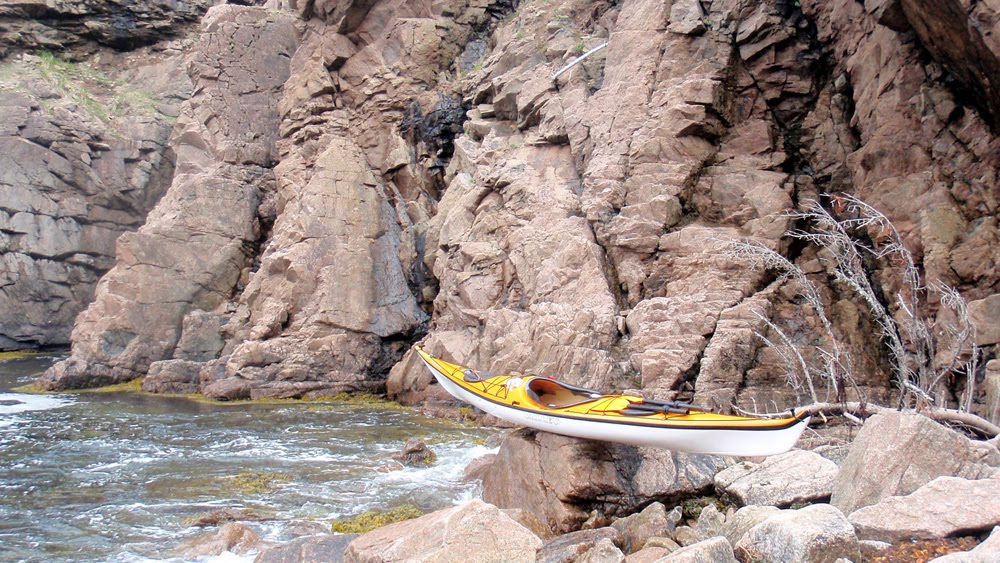
Constant rocks and sunkers offshore

There were a lot of offshore rocks and sunkers for such an exposed and unforgiving coast.


Into Cinq Cerf Bay

Ralph's original paddle plan was to paddle into Cinq Cerf Bay and paddle inside of all the islands. At the bottom of the bay a salmon river ran out that on the map looked like it had potential to be a beautiful spot. We didn't make it. We did paddle inside of Cinq Cerf Islands, Shag Island but then outside of Blackhead Island to cross directly to Shot Bag Island and Long Point at the other end of the bay.

Looking for a rest stop

Having paddled through Cinq Cerf Bay we paddled around Long Point hoping to find a suitable place to take out for a rest. It didn't look good but as we looked across to Captain's Island we saw what looked to be a suitable beach so we carried on for almost another hour as the far away beach beckoned.

Caribou

A couple of caribou were on the beach at Captain's Island to greet me. The female and calf had come down to the waters edge for the salt water. They saw me and wandered up into the hills where a stag stood watching over them. These chance meeting are always a nice surprise.

We took out here for our first rest stop of the day.

The fog rolls in

As we sat having our snack break the fog rolled in. It was bright and I suspected the sun would burn the fog off after a while but we left Captain's Island in fog. Stan took charge of Ralph's GPS and led us through the fog around Smoky Island and Muddy Hole Bay. As we crossed Muddy Hole Bay the fog did lift to show we were on target for Muddy Hole Point. I could see bottom in the middle of the bay and thought how interesting this place would be in a sizeable swell.

Connoire Head

Connoire Bay was a crossing of 1 hour as we paddled directly across the mouth of the bay from Muddy Hole Point to Connoire Head. We swung around the Head and in pretty calm conditions and paddled towards Wreck Island. We were ready for a pit stop with over 30 kms under our hulls already on the day.

Paradise

As we came around the top of Wreck Island we were welcomed by this inviting sandy beach. More than a pit stop, we decided that we'd stay here for the night. The forecast for the next day was favourable which meant we didn't have to run in front of the weather.

Our Wreck Island home

Above the beach a level grassy field with a great view made for an ideal campsite. Looking back in the direction we came from I could see the Blue Hills of Grand Bruit and I marveled at how far we had paddled. Actually, I was astonished how far away the hills looked.

A strand of sand

We had a beautiful sandy beach to call home on Wreck Island.

Burgeo is that-a-way but well over the horizon. We sensed the the trip was winding down.

Fire on the beach

Our bellies satisfied with supper we gathered some firewood on the beach and had a bonfire. Later as the fire died down Ralph made notes of the day's paddle while I played it over in my head. We went to bed contented with the day's activities and slept well after the 36 km paddle.

84 kms paddled and good weather predicted for the next day that would see us back in Burgeo.

Sunday, July 11, 2010

La Plante Harbour to Grand Bruit

A new day awaits

We awoke to glorious sunshine after camping in La Plante Harbour some 26 kms from the start of our journey in Harbour le Cou. There was still a bit of fog laying on the hills but we knew the bright sunshine would burn off any residual fog after breakfast.

We were taking our chances paddling this coast at this time of year but so far the gods were smiling on us.

In La Poile Bay

The plan on this day was to paddle into the bay to see the community of La Poile, cross over and paddle around in Roti Bay and into Grand Bruit.

La Poile

La Poile is a community of some 200 residents. Its isolated and serviced by the same ferry that serviced Grand Bruit. The ferry Marine Eagle can take 12 passengers; 4 seats reserved for Grand Bruit residents and 8 for La Poile. That results in some shoving and pushing to get on the ferry.

The brother of Ralph's partner taught here some 30 years ago and Ralph wanted to see the place. Turning away he said "Check that off the list".

Heading for Eastern Point

We had paddled some distance into La Poile Bay to see the community of La Poile. The original plan was to cross the Bay and up the eastern shore. Instead Stan picked a course directly aimed at Eastern Point so we did a diagonal crossing of about 6 kms.

Pit stop

Eastern Point at La Poile Bay is a headland where normally conditions deteriorate and they did slightly. It got a little bumpy but very manageable. Two hours into the day's paddle and we figured a stop was in order. We found this sheltered beach just before French Cove and opposite Jacques Island.

Inside Jacques Island

We had stopped for a break on the mainland in a passage between it and Jacques Island. To the right at the bottom of Jacques Island, Roti Bay opened up for our run into Grand Bruit.

In Roti Bay

Rounding the bottom of Jacques Island were were out in Roti Bay proper. Ahead of Ralph lay Gull Island and as we paddled along we could see the transmission tower on the hill by Grand Bruit. We were making good progress in the perfect paddling conditions.

Entering Grand Bruit

The sun was shining brightly as I entered Grand Bruit just after 1:30. It was hard for me to fathom that I was back already given the length of the ferry ride out. The saying "The longest journey starts with a first step" is so true. Almost 50 kms one paddle stroke at a time.

The building clouds foretold of changing conditions and we were onshore only a matter of an hour when the winds picked up. Out on the bay where we had just paddled the wind had created many whitecaps. We were done for the day.

Centerpiece

The church is the centerpiece of most Newfoundland communities. Its usually positioned on a higher piece of ground and acted as a beacon for fishermen returning from the fishing grounds.

Grand Bruit has two - the church and the falls.

The water of a freshwater lake behind the community spills over a ledge that's about 15 metres high. It and the church behind are an awesome spectacle to see as mariners enter the harbour.

Room at the Inn?
Ralph chats it up with Joe, proprietor of the Cramalott Inn. I don't know if he's trying to check in at the wharf but it turned out the three of us stayed in the community church for the night. We were in good hands! It was a unique opportunity and meant a lot of our gear could be left in the boats making for an early departure the next morning.

A shortish paddle of 22 kms on this day for total of 48 - almost half way.

Saturday, July 10, 2010

Harbour le Cou to La Plante Harbour

Harbour le Cou

Harbour le Cou greeted me as I looked out my tent door first thing in the morning. I heard Ralph zip out and that was my cue to get a move-on. I had a breakfast of stick-to-your-ribs porridge to fortify myself for the day ahead. A quick listen to the marine weather forecast let us know we wouldn't be forced to stay on shore as we got all of our necessities crammed into the kayaks.

Finally, on the water

After 2 days paddling around Burgeo waiting for the scheduled Tuesday sailing and after 2 more days of off and on trepidation over whether we would be able to get on the ferry, we were on our way back to Burgeo some 100 kms back up the coast.

Sugarloaf shrouded in fog

The fog hung low over the hills looking down the arm towards Lobster Cove in Harbour le Cou let us know what was in store. It wouldn't get much better during the day as we set our sights on Indian Harbour and our proposed first night's campsite.

Is that Petites ahead?

Outside of the harbour the fog proved to be fairly thick. Near the resettled community of Petites there are a number of small islands and sunken rocks (sunkers in Newfoundland speak) that proved to be a bit unnerving. The swell was breaking over the sunkers that were only heard as they were hidden in the fog. Stan made sure we steered clear of danger and we passed safely.

Kelp bed stop

About 2 hours into the paddle and having completed the most demanding section passing Petites and its rocky islands in fairly thick fog we stopped at this location. There aren't many options along this coast so if ya see a rest stop its best to take it.

Big Seal Island

Invigorated after a short stop we paddled between the mainland and Big Seal Island. The south coast is an unforgiving coast for the most part but there were opportunities to skirt inside of islands to escape the constant swell. Here, the boys approach Sarsaparilla Point ... jeesh, who comes up with the names? A returning tourist from Mexico?

Hatcher's Cove opens up

In Little Garia Bay the fog lay low in the distance, always threatening to envelope us. Ralph had a GPS but I knew the sound of swell breaking on port meant we were on course whether we could see land or not.

Duck Island

Passing inside of Deer Island and Pigeon, Tinker and Whale Islands we didn't have much swell. We paddled also inside of Duck Island but then had to veer south and swing wide of a string of small islands and low rocks the swell was breaking over.

Campsite La Plante Harbour

After 26 kms paddling and one stop we arrived at our campsite for the night at La Plante Harbour. When Ralph planned the trip he selected Indian Harbour for the first night campsite but this turned out to be a good choice. There are cabins at Indian Harbour and I'm not a fan of cabins because they remind me of civilization.

The fog rolled in and out all evening but it didn't dampen our spirits. We were on our way and had a quarter already behind us.