Translate

Showing posts with label Flat Islands. Show all posts

Monday, August 17, 2015

Bonavista Bay - Finishing the trip


Sunday, the fourth day and final day of our trip in Bonavista Bay, we agreed on a 8:00 am departure time.  Breakfast was cooked, tents taken down and gear made ready to stow in our kayaks.


On the water at 8:10 we left Flat Island and made for the opening between Bessy Island and Shelf Island heading almost due south.  Winds were forecasted to be from the northeast at 25 kms so if they did materialize they would give us a good push to our destination.


A short 1 km crossing from Bessy Island had us at Willis Island.


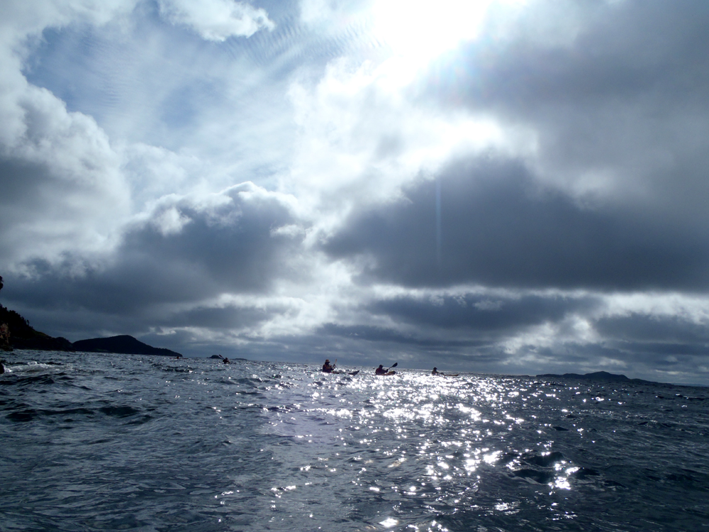
Behind us the morning sun crept higher in the cloudy sky while ...


... in front of us lay Varket Channel, a 2.5 crossing from Willis Island to Morris Island interrupted half way by our target of the two hilled Varket Islet.


We had a short stop at Varket Islet to discuss the next objective.  It was decided to continue southwest to Morris Island which would keep the building waves to stern.  Dean, Terry and I however got approval to paddle more southerly in the beam seas and meet the rest at Morris Island.


It was 10:30 when we made Morris Island.  As it was early we had a time-out and stretch before making our final 3.5 km crossing for the day back to our vehicles at Burnside.


Paddling through a narrow channel west of Squid Island we ...


... caught sight of the houses of Burnside.


All good things have to come to an end and so it was with our four day exploration of the islands in Bonavista Bay.

We were lucky with the weather and with the company.  An excellent trip totaling 95 kms.


Here's the track for the return home on day four and ...


... here are the breadcrumbs for the entire four days.

Sunday, August 16, 2015

Bonavista Bay - In and around the isands (2)


We continued exploring along the shore of Willis Island after eating lunch and then crossed over to Bessy Island where we paddled between it and Fuzz Island and back to Flat Island where we ...


... poked into every crevice and ...


... nook, however dark it was out of the sun's reach.


Eventually Piffin Island came into view.  We decided to paddle outside of it to see if there were puffins on it  Maybe at another time of year but not on the day.


 Some of us could not resist the temptation of challenging the surf at the north end of Fat Island.  Hazen's photo.


 Almost back at camp we paddle through this protected channel.


 As the evening progressed the water dropped and at low tide the rocks emerged in this channel that hours earlier I managed to get through but did have to knuckle walk the kayak in a few places.


Wood was scarce but we did manage to gather enough to have a fire which became ...


... the center of attention as darkness began to settle over ...


.. our second night on Flat Islands.

Friday, August 14, 2015

Bonavista Bay - In and around the islands


On Thursday we left Burnside and camped at The Beaches.  Friday we paddled by way of St. Brendan's to the Flat Islands.  Saturday we decided to leave the tents up and paddle around the islands.  Flat Islands is a collective name for a grouping of flat-topped islands - Flat (Samson) Island, Berry Head, Cowards Island and North Island, Inside and Outside Battery Islands and Puffin Island.


I took all the gear out of my kayak and stowed it on the beach above the high water mark.  The kayak felt lively empty compared to its fully loaded weight.  We went northwest along Flat Island where a relic of previous settlement still stood and up on the hill there was still an old cellar.


The water was perfectly calm as its protected by the cluster of islands.


Paddling between North Island and Inside Battery a cemetery came into view as I came around the corner


Dean, Derek and I got out to have a look around and read some of the names and dates on the tombstones while the others ...


... carried on past but parried while we were ashore.


The three of us got back in our boats and the group carried on to the Coward Islands where a derelict house still stood.


We meandered along the shores of the Coward Islands, passed between them and Philpotts Island, crossed to Turners Island.  There we paddled between Turners and Willis Islands and entered a small cove.  Looking on the bottom we spotted good sized mussels.  Some of us jumped out of our kayaks into the waist deep water to collect some.


I stored the mussels I gathered behind my backband and when we thought we had enough we continued past alongside Willis and Ships Rock.  In another small cove we took the chance to top up water supplies.


We were in no hurry as we didn't have to set up camp at the end of the day.  Every channel invited a passage.


An inviting beach on Willis called us in and we set about making lunch.  Ron and Derek got water boiling so the mussels could be sampled.  Handfulls of mussels entered the pots but less than half opened in the boiling water.  They looked fine but were discarded for safety reasons.

After lunch our next destination was Bessy Island.

Thursday, August 13, 2015

Bonavista Bay - Flat Island walkabout


There are hundreds of isolated communities in Newfoundland that were settled hundreds of years ago that were resettled in recent times.  Visiting the sites of these resettled communities on kayak trips is a great draw for me because being there really gives a feeling of what it must have been like to survive, and yes, survive is an apt word.  The people who lived there no doubt saw it as making a living.  Seeing it with the backdrop of modern amenities it seems more like survival.

Flat Island where we were camped was settled in the 1820s.  "... it was settled first by families from Greenspond (Jonas Hallett, an immigrant from Somerset, England and his wife Sarah; a Dyer family, and James Cheater) and Kings Cove (the Samson or Sanson families of Thomas and Jane, Joseph Sr. and Elizabeth, Joseph Jr. and Mary Conoly, James and Susannah Butt).  [From: http://www.heritage.nf.ca/articles/society/flat-islands.php]

Subsequent credit to the above site will be referred to as Heritage Nfld.


The last people of Flat Islands to leave left in 1957 under the Government of Newfoundland resettlement program.  There's not much left to evidence the existence of a community that once peaked at 502 in 1901.  All that's left are a few rotting boards and sticks and scattered bricks.

The population in 1836 shows 26 growing to 108 in 1845.

"The populating process, however, was greatly influenced by an influx of settlers from Conception Bay particularly from the Port de Grave area." [Heritage Nfld]


There were no supermarkets then.  People survived by fishing and growing their own vegetables.  In the spring men went to the ice to hunt seals for meat which must have been a nice change form fish and potatoes.


Flat Islands were pretty much "out the bay" as far as one can get.  As fishermen had to row their dories out to the fishing grounds, the islands were well placed.

" Nourished by the local inshore fishery, the seal fishery and activities such as woodcutting and ship building, but most especially the Labrador fishery, the Flat Islands population increased to 891 persons by 1901."  [Heritage Nfld]

The population quoted appears to differ from census data which shows 502.


I was surprised as I scanned around the island how much land was available for agriculture compared to other resettled communities where I've been.

The vegetables that were grown had to do for the entire year until the following year's crop could be harvested.  The harvest was stored in cellars that kept produce from freezing in winter.


On Saturday we toured the other side of the island having seen the white tombstones from our kayak tour around the Flat Islands.  There were three graveyards, the first one not far from the community.  There didn't seem to be much earth where the graveyards were situated and, it appeared to me, that as the useable ground was exhausted in the first location they moved a little down the shore to establish a second.


This old tombstone caught my attention.  It marked the resting place of William, son of James and Hannah Philpott, who died in 1856 at the age of 1 year and nine months.

"By 1857 Flat Islands had a population of 210 and nine of the sixteen surnames represented in the community originated in Conception Bay. Parish records suggest that the Kelligrew and Ralph (Roff) families began the influx from Conception Bay and were followed by Butts, Crockers, Morgans, Pettens/Pettons, Philpott, Pikes and Powers/Poors." [Heritage Nfld]

Isolated as they were on Flat Island people had to tend to their own medical emergencies.


From the site of the second we could see a third further still.  We walked on to investigate the third.


Monkshood (Aconitum) were growing everywhere in the yard.


Some of the tombstones in the third were more elaborate than those of the first two while all had burial dates were into the 19th century.  Carvings on the stones indicated they originated from the capital St. John's.  They must have cost a pretty penny suggesting the people were prospering.

The people may have been prospering but after 190 the population census shows a steady decline from 502 to 370 in 1911 to 339 in 1945.  " In the mid 1950s the Flat Islands community began to disperse. In 1957 the remaining families took part in a government resettlement scheme and the islands were left without year round occupants." [Heritge Nfld]

There are a few cabins on Flat Island so some of the descendants have not forgotten their heritage.  But, I suspect most who settled on the Eastport Peninsula have.  Sadly, those people and their way of life have faded into history.

Wednesday, August 12, 2015

Bonavista Bay - On to the Flat Islands


Thursday we left Burnside and camped at The Beaches.  Friday morning began sunny with some clouds as we packed our kayaks to begin our paddle to the Flat Islands.  We left The Beaches to cross Bloody Reach to enter Cottel Reach.


There was a little wind blowing that with the long fetch made things a little choppy.  The wind though was mostly at our backs so it made paddling easy.


There were little wind waves to catch small surf rides.


Dean and Hazen enjoying the push along the shore.


Cottle Reach is a channel of 10 kms running between Cottle Island and Lakeman and Pitt Sound Islands.  We reached the north end to paddle into the community of "Burnside", er, Hazen means St. Brendan's (because Hazen couldn't stop from misnaming the community lol).


As we entered St. Brendan's a cold front swept through and things got a little uncomfortable as we cooked lunch on the beach.  Luckily it was only momentary and the sky ...


... brightened up again over Main Street.  St. Brendan's, like many outport communities, is in decline and what were going concerns in better times are now boarded up.


I wondered if John Croke could still be reached at the phone number?


Passing across the northeast side of Cottle Island we turned southwest inside Hunch Island and past Dock Cove before turning southeast passing several small unnamed islands to make a 4.5 km open crossing to Berry Head in the Flat Islands.


Whereas it looked like cold wet weather when we had lunch at St. Brendan's, it was warm and pleasant when we set up out tents on Flat Island; Flat Island being one of a group known collectively as the Flat Islands.


Looking out over what would be our new home for two days.


I walked around in the area of our campsite to see what was left of the resettled community.  Rotting boards testified to where structures were left to fend for themselves.  Then it was time to begin the festivities.  It was time for happy hour.


We collected some wood to have our usual fire as the evening turned into night.  Again we had a totally clear night with a sky awash with stars and the Milky Way wheeling overhead.  A wonderful end to our second ay exploring the islands of Bonavista Bay.


Here's the track of our second day for a total of 31.5 kms.