Translate

Showing posts with label Bull Arm. Show all posts

Wednesday, May 10, 2017

The best laid plans go awry in Bull Arm


Last October a group of us were in Bull Arm to check out the arrival of the topsides for the Hebron oilfield production platform.  The gravity base structure (GBS) was complete and floating in Mosquito Cove.  The topsides were on shore waiting to be mated with the GBS.

Now, seven months later the GBS was ready to be towed out to the oilfield and were were back in Bull Arm hoping to see it pass by.  However, ice offshore, as shown in the above screen shot from Environment Canada, cancelled the tow out but we went anyway to see the completed GBS.


We all spent a cold night in the tents and the day didn't start off very pleasant either.  It was misty, cold and raw.  Slowly we got on the go and ...


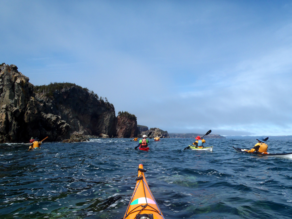
... left our campsite inside Masters Head and ...
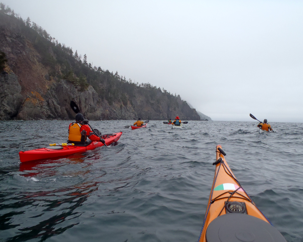

... entered Bull Arm paddling north into a northerly breeze.


Clyde, in the orange, and I donned our cags that made the conditions more tolerable.  I didn't anticipate the cold weather and didn't have a second layer of clothes so the cag was a lifesaver so to speak.


We stopped in Stock Cove to do a quick check of the archaeological dig establishing the presence of Paleoeskimo at the site.  I spent more time here last October walking about and posted a blog entry with more information on the excavation so I'll just point to that post here.


We got our first view of the GBS in the distance.  Mosquito Cove is a restricted construction site.  We stopped just before the cove but ...


... slowly paddled and drifted closer and ...


... closer until we saw a launch approaching letting us know we were spotted.


The guys weren't heavy handed but were quite cordial telling us we were in a restricted area.  We chatted for a while and before leaving Brian passed his camera over to one of the guys asking him to take a ...


... picture of all of us with the GBS in the background.  Left to right we have myself, Gary, Cathy, Roy, Brian, Terry, Clyde, Hazen and Ron.

So, while we were disappointed the tow out didn't happen it was still interesting to see the thing.  Especially I think for Cathy, Hazen and myself who were here last year.

Coming as far as we could, we paddled back to the campsite to break camp and then back to Chance Cove to the cars and the drive home.

Thanks to Hazen for doing the planning and organizing.

Tuesday, May 9, 2017

A hobble in Bull Arm


Sometime on May 8th the Hebron oilfield production platform, a gravity base structure (GBS), was tentatively scheduled to be towed out of the construction site in Bull Arm.  Seven tugboats were contracted to do the tow out but nine of us decided we had better attend in case they need more towing power.

The plan was to leave from Chance Cove and camp at Masters Head Beach and monitor the situation as to when the tow-out would proceed.  On a bright sunny but cool Sunday morning Brian, Cathy, Clyde, Gary, Hazen, Ron, Roy, Terry and I loaded our kayaks on the slipway in Chance Cove.


Loaded down with all the camping essentials we left Chance Cove and ...


... headed northwest along the shore.


The shoreline along here is punctuated by sea stacks of the Bull Arm Formation comprised mainly of andesitic volcanic flows.  That is to say, the same composition of the rocks of the Andes Mountains in South America.


Its one of the most picturesque shorelines on the Avalon Peninsula which is hard not to get ...


... enough of.


Near Rantem Harbour we paddle past the last of the sea stacks where a bit of mist hung in the air.  We crossed directly over bypassing the harbour and landed on the opposite shore where we examined ...


... the lone bergy bit in the area.  This shot is for Brian, Hazen and Terry who made the longer crossing to ...


... the beach just inside of Masters Head.  They were soon joined by the rest of us and we all set up camp.


Its not only an army that marches on its stomach.  We had to fuel up too for the tow we thought we might have to assist with *lol*.


We all pitched in to collect firewood for the evenings campfire which we knew we'd need as temperatures were expected to drop to near 0C.  After we had a good pile of wood stacked up Brian, Cathy, Gary and I followed the start of a moose path up through the trees to climb up to the top of the Head.


Its was a cool breeze (guessing 5C) but the exertion of the climb had us plenty warm.  We had a nice view of Trinity Bay from our vantage point some 50 meters above the water.  I couldn't resist throwing a few rocks over and watch them kerplunk into the water below.


After ten minutes or so we made our descent picking our way through a mass of dead trees and windfalls.


Just after 7:30 fire chief Terry decided it was time to get the fire going.  It was still an hour and a half from darkness but a welcome warmth as the sun began to set loosing the heat it provided.


As night drew on and the cold set in, we began to stand closer to the flames.  Warmed by the fire people started to drift away to the tents steeled against the cold that was expected to hit near freezing.

As it turned out, the tow out was cancelled due to ice conditions in the tow path.  We would not be needed after all!!!  Nevertheless, the next day we planned to paddle down Bull Arm to the construction site at Msquito Cove where the gravity base structure bobbed in the water waiting patiently for the move.  More on that later.

Monday, October 10, 2016

Chance Cove return


Where was I before I dosed off?  Oh yes, camped on a beach inside Masters Head with Cathy, Dean, Derek, Gary and Hazen.  The day before we set up the tents and three of us went to check out Stock Cove and the Bull Arm construction site.

We got up in the morning to a beautiful sunny day but where we were camped we were still in shadows early on.  Slowly but surely ...


... the sun began to rise and bathe the campsite in warm sunlight.


The paddle to the campsite from Chance cove was just over 6 kms because we made a crossing of Rantem Harbour.  On the way back the plan was to handrail and take our time ...


... squeezing through narrow openings and ...


... around sea stacks.


We explored every nook and cranny, here where a brook ran out.


Another sea stack!


Dean was up at the crack of dawn and told the late risers that there was a skim of frost on his kayak when he got up.  The change of season and the cooler nights were having an effect on tree leaves as they began turning from green to yellows.  The dogberry trees seemed to be leading the way.


We saw numerous eagles.  At one point in Bull Arm on Saturday we saw three close together.  Usually they cry out and take to wing trying to lead us away from their nest sites.  This eagle didn't move and was the closest I ever got to take a picture.  We thought it might have been injured so we backed off so as not to stress it.


Within sight of Western Head we stopped on this beach to relax for some time.  It was still early and we were in no hurry.


From Western Head its only as short distance back to Chance Cove.  That part of the shoreline is punctuated with numerous ...


... sea stacks, this one being the biggest.  Not a sea stack but and island really.


We hit the water at 10:00 and 12:30 we were back entering Chance Cove.  We doubled the distance of 6.2 km on Saturday, which included a crossing, on Sunday by hugging the shoreline.

It was only a one night camp out but felt longer because we stuffed the day with wonderful paddling, incredible scenery and great company.

Here are the breadcrumbs on a Google Earth screen shot:


Tuesday, October 4, 2016

Plan the paddle; paddle the plan


After visiting the Dorset Paleoeskimo site at Stock Cove, Cathy, Hazen and I continued our paddle into Bull Arm towards the Hebron GBS (Gravity Based Structure).  The GBS will be positioned in the Hebron oil field of off Newfoundland to exploit that resource.

We kept guessing at what point we'd catch sight of the GBS and finally we did sight it some distance off.


At the entrance to Mosquito Cove where the construction site is, I noticed a sign indicating it was a restricted area.  I thought about it and resolved it didn't apply to small craft like kayaks so I started to paddle across the cove and caught sight of the top sides.  The previous picture was the GBS, this was the actual production module and crew quarters.


The wind was blowing pretty good out of the cove with numerous white caps.  Edging into the wind I got closer and ...


... closer till it almost filled the field of view of the camera.  To say it was massive is an understatement.  The topsides itself is 110 meters high.  I imagine that would be to the top of the derrick.


So far so good, I was either undetected or no one cared about a guy in a kayak.  I was making my way across the cove towards the head there in the distance where I thought it would be close enough to get a decent picture.


I arrived at the point of land to grab a picture.  I dared not tempt fate and go further as I may have been pushing my luck because as you can see ...


... if you click on this to enlarge, I was well within the construction zone marked off on the blue chart.  I edited in the position of the GBS in red.

The GBS is 120 meters tall and 130 meters in diameter at the base.  They started the GBS in drydock and then after they had slip-formed so high that it would float, they towed it into deeper water to continue slip-forming with concrete, topping the base off with the part now sticking out of the water that the topsides will be fitted to.

Bull Arm is the ideal site for this construction as 100 meters off of the coast the water reaches over 500 feet in depth.


Cathy and Hazen didn't follow me across the cove so we met up again as I returned.

The wind continued to blow at our backs for the 9.3 km paddle back to camp which we knocked off at an average speed of 8 kms/hr, arriving back at the campsite where we hoped the others had things in order with wood collected for the evening's campfire.

A shortish paddle of 6.2 kms from Chance Cove to the campsite and a 26.4 paddle to and from Mosquito Cove gave the three of us a respectable 32.6 for the day.  It was the plan I proposed earlier in the week.  I was pleased and appreciated the company of Cathy and Hazen to see the plan completed.

Monday, October 3, 2016

Visiting the Dorset Paleoeskimo in Stock Cove


The plan was to paddle from Chance Cove to a campsite just inside Masters Head, set up camp and then proceed into Bull Arm to investigate an archaeological site at Stock Cove and thence to the construction site for the Hebron GBS.

When we got the tents set up it turned out Dean, Derek and Gary were going to spend the afternoon relaxing in camp.  Cathy, Hazen and myself stuck with the plan and headed around the headland and into Bull Arm.


The clear sky started to cloud over but it was sweet paddling.  Bull Island hovered on the horizon.


Hazen had to stop to rest a shoulder injury sustained out fat biking.  Cathy stayed with him while I continued on to Stock Cove telling them I'd wait there.  Eight kms from Masters Head I spied Stock Cove.


I wasn't sure exactly where the site was in Stock Cove so I just pulled up on the beach and got out to investigate.  I walked up from the beach and ...


... into the woods.  It didn't take long before I spotted a piece of blue tarp poking out of the ground.  A dig had taken place and recovered.  I was in the right place.

The Dorset occupying this site belong to the "Early Palaeo-Eskimo" phase dating from 3800 to 2200 years before the present date.  The site possibly looked much like it does today but many generations of trees have fallen and regrown since they were here.

As I looked out through the trees to the ocean beyond I wondered what was so appealing about this site.  Today its certainly not close to their main source of food, namely seals.  Possibly they came here during the winter for the shelter and access to caribou and other land game?  From this spot I followed a well defined path  that led to ...


... the main excavation site where the current summer digs were exposed.


I walked around to try to get a shot with my kayak in the picture which lay on the beach in the distance.  I wondered if the Dorset had come here in kayaks themselves?  Surely some must have.  I wondered what the site would have looked like with people milling about and shelters and kayaks on the beach.  So much time between them and me.  It made me feel very small in the grand scheme of things.

Nothing lasts forever.  Even this site.  The rise of sea level in the intervening period has changed the site from when it was occupied.  Archaeologists have documented thousands of artifacts that have been washed out and onto the beach.  That raises the point that visitors like myself should not collect or disturb anything on the site.  The Historic Resources Act of the province in fact prohibits it.


A message was propped up which read: "Please do not disturb!  We'll be back next year.  Follow us "Stock Cove Archaeology Project" on Facebook for updates".

There's also a blog that can be checked out plus a number of Google hits for anyone interested in further info.  I'm just scratching the surface here.


I was careful not to disturb anything but I did pick up one artifact from the current period.  Someone had left an opened can of pop standing upright, still with some of its contents.  Some people just have no respect.

There are other locations of Peleo-Eskimo occupation as shown on Heritage Newfoundland website (credits noted in the image):


Soon Cathy and Hazen arrived and we were on our way to check out the Hebron Gravity Based Structure (GBS) deeper in Bull Arm at Mosquito Cove.

Addendum:

I subsequently found a map produced by the Provincial Archaeology office that showed Dorset Paleoeskimo sites in Trinity Bay at and near our campsite.  The red oval on the map is where we camped inside of Masters Head and the red circle is the Stock Cove site.  I had no idea that there were so many numerous sites until I did some research for this blog post.  Here's the map: