2 days ago
Showing posts with label New World Island. Show all posts
Sunday, July 7, 2013
Endgame - closing the circle
We had gotten up at 4:30 the morning of day five of our circumnavigation of New World Island and North and South Twillingate Islands to escape the northeast winds and get around the northern end of the island.
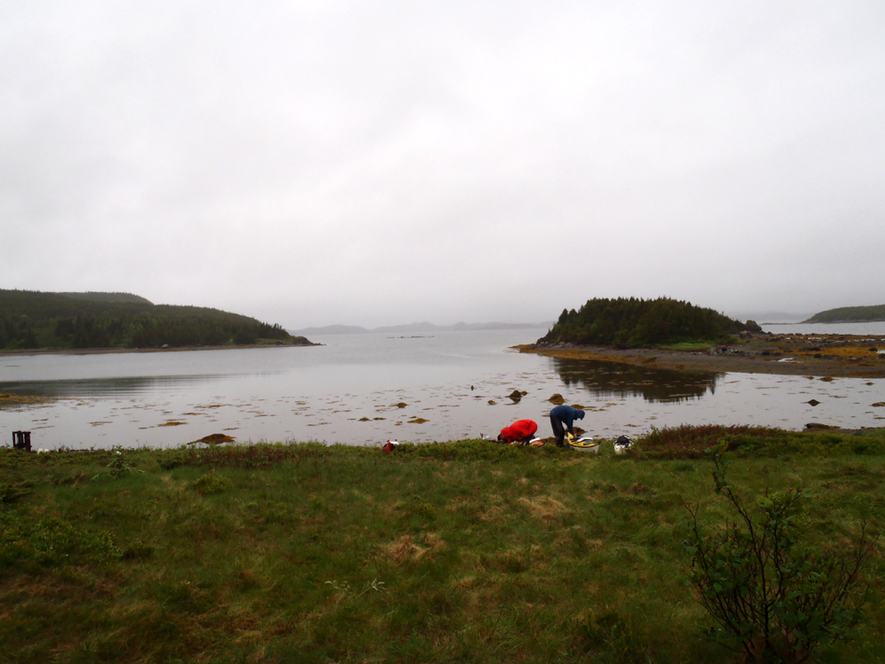
Due to the early start we arrived at Intricate Harbour, 27 kilometers later, at 11:15. Dean had identified a cove where we could camp. We did a recon. It was perfect. It was level and protected from the wind. Dean picked out a spot for his tent.
Then, three of the guys decided they didn't want to spend the best part of the day in camp and opted to continue on to Dildo Run Provincial Park. As Dean and I had carpooled, we had no choice but to come along.
Warning! This is more text than spectacular photos.
Three kilometers after leaving Intricate Harbour we turned east and were face and eyes into a 20 knot wind. Dean and I crossed over to Farmers Island. Brian, Hazen and Neville carried on following the coast. At Scrub Island we stopped for 15 minutes trying unsuccessfully to hail the other three on the VHF.
We carried on getting some protection from the wind from Scrub, Cone, Coffin, Transit and an un-named Island. Rounding the un-named island (which I'll forever call Sight for sore eyes Island), I saw the Curtis Causeway in the distance. But the wind was in our faces again and it began to rain heavily, so much so, I could only squint to see in the stinging rain.
Brian, Hazen and Neville had arrived at the causeway a few minutes before us and were waiting I cursed the 15 minute stop.
We arrived to find the tide in retreat and the tidal current against us. Yes, we had tide tables and a marine chart but failed to refer to the marine chart for direction of flow.
Brian tried to paddle through the current but was swept down stream. He summonsed us to the other side and Hazen followed but Dean, Neville and I carried our fully loaded boats over slippery, sharp rocks around the bridge abutment, attached a bow line and nursed the kayaks upstream along the side and out of the current.
Mine was the last and waiting to be put back in the water.
Our three kayaks were back in the water inside of the powerful tidal current. We had paddled already 40 kms and taken 30 minutes to get past the causeway. We had another 10 kms to go.
Ten kilometers to paddle through a maze of islands in the wind that was still blowing. The sea state was not an issue due to the limited fetch.
Finally we saw the knobby island that lay just outside of the park and the wind was somewhat behind us.
When our bows touched the sweet sand and the end of our journey it was 6:00 pm. We had paddled 50 kms (and a good chunk of it into the wind) since getting into our boats in Mortons Harbour at 5:30 am.
The final labour was to carry the loaded kayaks up from the beach to the road where we could unload them. It was a ragged looking crew.
With the gear loaded in the vehicles we went for a much appreciated shower even though the water coming out of the shower head was barely warm. Then we drove to Twillingate where Dean bought us all a supper of fish and chips.
In the morning we drove to Gander for breakfast and then hit the road for the 3.5 hour drive home.
The first two days of our trip were in glorious sunshine. The final three were cold and damp. I don't set out on these longer trips expecting perfect weather so I live with it. It is just part of the experience. A little adversity never hurt anyone.
So, the total circumnavigation was a few meters under 150 kms. It was a memorable trip. Thanks to Brian, Dean, Hzen and Neville for sharing the experience.
Here is the track for the final leg:
And, here is the birds eye view of the hole thing:
Saturday, July 6, 2013
Escape from Mortons Harbour
Northeast winds threatened to pin us in Mortons Harbour but we hatched a plan to beat the wind. We got out of our sleeping bags at 4:30 am and were on the water leaving Roses Harbour just before 5:30 without eating breakfast.
We crossed the entrance to Mortons Harbour oblivious to the residents who no doubt were still resting comfortably in their beds.
Already the water was active as we approached Western Head some 40 minutes later. We passed around the headland between Hussey Rock and Big Gull Island.
Around the headland and now safely sheltered from the northeast winds we paddled southerly in calm waters. I had identified Sams Cove as a possible camp site. Dean asked if this was it. Not quite but this was also a good camping location at Western Head Cove.
Further along these old fishing premises caught my eye at Valley Pond.
The seas were calm as we leisurely made our way south handrailing most of the way. Some of us did and some of us crossed the open coves like at Salt Pond with Green Island in the background. I especially enjoyed the relaxed pace after the last two days.
Just before8:00 we paddled into Little Bridgeport Harbour to ...
... stop for our delayed and much deserved breakfast.
Little Bridgeport Harbour lay at the mouth of an inlet that extends 3.5 kilometers inland were the community of Bridgeport is located. The shore was lined with various fishing stages and stores.
Some premises did not look to be maintained very well. Weathered silver grey they looked like they could use a lick of paint.
The crab fishery was over as crab pots were stacked waiting for next season's fishery. Fishermen subsist in these small Newfoundland communities fishing one species after the other in turn as the seasons open from crab, lobster, herring, squid etc. etc.
Bridgeport was scenic but we had to move on. Continuing south we crossed the mouth of Puzzle Bay until we reached Cottlesville. We floated in our kayaks for a bit before...
... being blown down this channel between Cottlesville proper and Cottles Island. I didn't paddle. The wind was strong enough to blow me along at a speed my GPS told me was 2 and 3 kms/hr though the picture fails to capture the breeze..
Leaving Cottlesville behind we were on our way to Intricate Harbour three kilometers away where Dean had identified a suitable camping opportunity.
And, here are the breadcrumbs for the morning and day so far:
Friday, July 5, 2013
2/3 round the circle by a toad's ass
At the end of our third day we camped on Black Island near the causeway connecting New World Island to Twllingate South Island. It poured rain overnight and was still wet when we got up to load our kayaks for the return to the shores of New World Island.
The rain had greened everything up. The other side of Black Island.
At the tip of Black Island we made a short crossing to South Trump Island continuing on alongside ...
... North Trump Island until we caught sight ot Tizzards Harbour.
We considered crossing to Tizzards Harbour but elected to cross straight to the point and the rocks known as the Toadasses.
The Toadasses from the other side. Whoever named these sure had a great imagination.
Leaving the Toadasses (another opportunity to throw that in *lol*) we paddled across Webber Bight to arrive in Wild Bight. Camping is an option but because it was still only 10:30ish we proceeded across the Bight in ...
... a stiffening and gusty breeze until we landed in ...
... Mortons Harbour where we conferred about a camping spot. I got out at Beachy Cove to have a look. A long grassy meadow entended all the way across to Wild Cove but was now fully exposed to the northeast winds. We poked into Roses Harbour where we found suitable camping.
Having arrived at Mortons Habour we had been in two of the three named towns in the traditional Newfoundland song "I'se the B'y" The key lyrics for us are:
"Fogo, Twillingate, Mortons Harbour
All around the circle ..."
We didn't set up the tents though as we wanted to see what Mortons Harbour had to offer. Turns out not much but we did replenish our water supplies with clear spring well water thanks to Louanne.
We decided to return to Roses Harbour to camp. While we dallied in Mortons Harbour the wind had increased and pushed masses of water out of the North Atlantic and into the narrow constricted harbour. The result was a 2 kilometer paddle into 1.5 - 2.0 meter waves and 20 knot winds.
We were happy to get into Roses Harbour and set up the tents under the trees in a wooded area.
Our kitchen area.
The sun made an effort to break through the dreary clouds. While not sustained sunshine, we could feel the warmth of the sun that helped dry our gear somewhat.
Looking out our protected home for the night.
The forecast for the next day was a strong wind out of the northeast. It would make paddling the north shore beyond Mortons Harbour Head and along Pomley Cove, Chockin Cove and Bladney Rock dicey. We decided on rising at first light to get around before the wind picked up. A 4:30 rise meant an early fire and an early bedtime.
The distance from Black Island to Mortons Harbour paddled on the day was 23 kms. Here's the track.
Wednesday, July 3, 2013
Day 3, the weather turns
The first two days of our circumnavigation of New World Island and Twillingate Islands were sunny. On the third day, Tuesday, the weather went south. We put ourselves in position to get around North Tillingate Island by compressing three days paddling into two. The long range forecast called for the wind to be out of the northeast.
We left Sleepy Cove just before 8:00 and had only a kilometer to paddle before we were around Lower Head and out of the wind. But the northeasterly winds blew of the cold North Atlantic waters and cooled everything down.
The easterly side of North Twillingate Island is dotted with communities. I prefer isolated coastlines but the circumnavigation meant the communities were in the tour. This is Crow Head. The other communities look pretty much the same.
An hour and a half after leaving Sleepy Cove we arrived at the fishing community of Twillingate. The bridge spans the gap between North and south Twillingate Islands.
We decided to have a look around the harbour.
I went to have a look at the big boys. While I did, the four other guys got out and bought coffees. A nice warm coffee did wonders for the cold but the waitresses had a polite way of suggesting we drink them outside - the coffee was served in take out cups.
Passing under the bridge again we headed southerly. Dean decided to don his cag. It made it easy to spot him in the bright reddish garment.
Minutes later with the tail wind and small following waves we were cruising past Ragged Point.
At Gillards Cove these old fishing stages looked like they've had better days. These stages are used to land, split and salt codfish for drying. In addition, these stages were used to store various fishing gear.
Five hours and 19 easy kilometers after leaving in the morning we arrived at Black Island where we set up camp ...
... in this sheltered little cove.
We arrived at Black Island just after 1:00 so we had an easy afternoon. We took turns collecting firewood for the evening's camp fire or sat under the tarp and chatted. I went looking for interesting ...
... rocks. Tectonic forces were hard at work. Here a granite crystalized and was later intruded by related magma. The difference is colour is caused by different rates of cooling. The lighter granite cooled slowly at depth forming crystals giving the rocks a lighter appearance. The darker dike cooled quickly against the cold granite walls with no discernible crystals, giving the rock a darker appearance.
Here's my effort at a technique used by Captain Kuk. Hope its not copyrighted Jim!
Rain was in the forecast so we got the fire going early. Besides, it was pretty cool and the fire would give us some comfort. Just after dark it started to rain and we all ducked into out tents. I drifted off to sleep as the rain pummeled the tent, wondering what day four would hold. Either way, it was so far, so good.
Here are the day's breadcrumbs.
Subscribe to:
Posts (Atom)