Translate

Friday, July 5, 2013

2/3 round the circle by a toad's ass


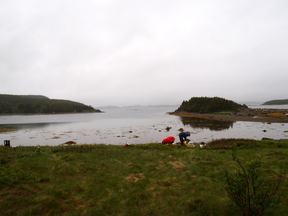
At the end of our third day we camped on Black Island near the causeway connecting New World Island to Twllingate South Island.  It poured rain overnight and was still wet when we got up to load our kayaks for the return to the shores of New World Island.


The rain had greened everything up.  The other side of Black Island.


At the tip of Black Island we made a short crossing to South Trump Island continuing on alongside ...


... North Trump Island until we caught sight ot Tizzards Harbour.


We considered crossing to Tizzards Harbour but elected to cross straight to the point and the rocks known as the Toadasses.


The Toadasses from the other side.  Whoever named these sure had a great imagination.


Leaving the Toadasses (another opportunity to throw that in *lol*) we paddled across Webber Bight to arrive in Wild Bight.  Camping is an option but because it was still only 10:30ish we proceeded across the Bight in ...


... a stiffening and gusty breeze until we landed in ...


... Mortons Harbour where we conferred about a camping spot.  I got out at Beachy Cove to have a look.  A long grassy meadow entended all the way across to Wild Cove but was now fully exposed to the northeast winds.  We poked into Roses Harbour where we found suitable camping.

Having arrived at Mortons Habour we had been in two of the three named towns in the traditional Newfoundland song "I'se the B'y"  The key lyrics for us are:

"Fogo, Twillingate, Mortons Harbour
All around the circle ..." 


We didn't set up the tents though as we wanted to see what Mortons Harbour had to offer.  Turns out not much but we did replenish our water supplies with clear spring well water thanks to Louanne.

We decided to return to Roses Harbour to camp.  While we dallied in Mortons Harbour the wind had increased and pushed masses of water out of the North Atlantic and into the narrow constricted harbour.  The result was a 2 kilometer paddle into 1.5 - 2.0 meter waves and 20 knot winds.


We were happy to get into Roses Harbour and set up the tents under the trees in a wooded area.


Our kitchen area.


The sun made an effort to break through the dreary clouds.  While not sustained sunshine, we could feel the warmth of the sun that helped dry our gear somewhat.


Looking out our protected home for the night.


The forecast for the next day was a strong wind out of the northeast.  It would make paddling the north shore beyond Mortons Harbour Head and along Pomley Cove, Chockin Cove and Bladney Rock dicey.  We decided on rising at first light to get around before the wind picked up.  A 4:30 rise meant an early fire and an early bedtime.

The distance from Black Island to Mortons Harbour paddled on the day was 23 kms.  Here's the track.


Wednesday, July 3, 2013

Day 3, the weather turns


The first two days of our circumnavigation of New World Island and Twillingate Islands were sunny.  On the third day, Tuesday, the weather went south.  We put ourselves in position to get around North Tillingate Island by compressing three days paddling into two.  The long range forecast called for the wind to be out of the northeast.

We left Sleepy Cove just before 8:00 and had only a kilometer to paddle before we were around Lower Head and out of the wind.  But the northeasterly winds blew of the cold North Atlantic waters and cooled everything down.


The easterly side of North Twillingate Island is dotted with communities.  I prefer isolated coastlines but the circumnavigation meant the communities were in the tour.  This is Crow Head.  The other communities look pretty much the same.


An hour and a half after leaving Sleepy Cove we arrived at the fishing community of Twillingate.  The bridge spans the gap between North and south Twillingate Islands.


We decided to have a look around the harbour.


I went to have a look at the big boys.  While I did, the four other guys got out and bought coffees.  A nice warm coffee did wonders for the cold but the waitresses had a polite way of suggesting we drink them outside - the coffee was served in take out cups.


Passing under the bridge again we headed southerly.  Dean decided to don his cag.  It made it easy to spot him in the bright reddish garment.


Minutes later with the tail wind and small following waves we were cruising past Ragged Point.


At Gillards Cove these old fishing stages looked like they've had better days.  These stages are used to land, split and salt codfish for drying.  In addition, these stages were used to store various fishing gear.


Five hours and 19 easy kilometers after leaving in the morning we arrived at Black Island where we set up camp ...


... in this sheltered little cove.


We arrived at Black Island just after 1:00 so we had an easy afternoon.  We took turns collecting firewood for the evening's camp fire or sat under the tarp and chatted.  I went looking for interesting ...


... rocks.  Tectonic forces were hard at work.  Here a granite crystalized and was later intruded by related magma.  The difference is colour is caused by different rates of cooling.  The lighter granite cooled slowly at depth forming crystals giving the rocks a lighter appearance.  The darker dike cooled quickly against the cold granite walls with no discernible crystals, giving the rock a darker appearance.


Here's my effort at a technique used by Captain Kuk.  Hope its not copyrighted Jim!


Rain was in the forecast so we got the fire going early.  Besides, it was pretty cool and the fire would give us some comfort.  Just after dark it started to rain and we all ducked into out tents.  I drifted off to sleep as the rain pummeled the tent, wondering what day four would hold.  Either way, it was so far, so good.


Here are the day's breadcrumbs.

Chillin' in Sleepy Cove


We arrived in Sleepy Cove after a 31.5 km paddle from Cobbs Arm.  The first order of business for me, on a sunny, dry day, is to get out of my paddling ear and into street clothes.  I find it a wonderful feeling of freedom.

We sized up the the camping situation and decided to set the tents up on a level shelf on the beach that we thought was above the high tide line.


Sleepy Cove is the site of a former copper mine started by ex-pat Obediah Hodder.  It was an unsuccessful venture (you can read more here) and some of the abandoned machinery was left behind scattered around the cove, now painted bright red and yellow ...


... standing as sentinels over the little cove where hopes for riches were dashed.


There is copper in the rocks that were formed by volcanic activity, just not enough to sustain a successful mine.

The cliffs of Sleepy Cove contain examples of pillow lavas.  Pillow lavas are created when lava is extruded under water.  The pillow lavas formed at Sleepy Cove formed some 500 mya when the Iapetus Ocean stopped opening and began to close.  A volcanic island arc formed where one oceanic plate was subducted under the other as the continents began to drift together again.

It look like a jumbled mess but near the top of the picture rounded forms of the pillows can be made out.


The tide was rising throughout the evening and at one point we wondered if the tents were safe.  We sized up the level of the sea.  Did we have enough room?  We weren't sure so we moved the tents up on the grass above the beach, probably where we should have set them up in the first place.


With the tents moved and now out of the reach of the tide we set up the kitchen and began supper.


It was a good thing too that we moved the tents, the water eventually reached the level of where the tents stood.


There wasn't much wood on the beach for a fire.  Nonetheless, we managed to scrounge enough wood and picked a spot to pile it ready for when it got darker.


So, we had our ritual fire on the beach, a few swallies and some light hearted comments and laughter.

We were on a kayak trip around New World Island and North and South Twillingate Islands.  The focus is on kayaks but for me a big part of the whole trip is the camping and relaxing after a day on the water.

Tuesday, July 2, 2013

Day two ends in Sleepy Cove


We had left Cobbs Arm on New World Island at 7:30, paddled through Pikes Arm, crossed over to South Twillingate Island.  We lunched at Codjack Cove after paddling near 20 kms.  We were now paddling among more dramatic granitic and volcanic rocks.


Clam Rock Head in the distance.


Neville paddles by a grey sea stack that stands out against what looks to be rust stained rocks.  Hard to say exactly from the seat of a kayak, from a distance and without a rock hammer.


Looking down into Spillers Cove.  We didn't paddle into the cove as it would have doubled the distance of just paddling across the mouth.


Almost across Spillers Cove we approach Spillers Point.


At Spillers Point there was a channel we could paddle through that looked as spectacular going in as ...


... coming out.


Heading for French Head and Burnt Island in the distance.


The sawtooth rocks off of Long Point.  We probed and found a way through saving us having to go all the way around.  We approached Long Point paddling WNW.  We knew the winds were blowing out of the SW and as we rounded the Point we felt the force of the wind.  We weren't far from Sleepy Cove and after battling the wind for a kilometer we ...


... arrived at the welcomed sight of the cove at just after 4:00.  We had paddled 31.5 kms on the day after leaving Cobbs Arm at 7:30, a good bit of it into the SW wind.

Here are the breadcrumbs we dropped in the sea after our lunch stop at Codjack Cove.:


Monday, July 1, 2013

From Cobbs Arm to Codjack Cove


Monday, day two, of our circumnavigation of New World Island dawned bright and sunny.  We were underway at 7:30 and preparing to head north.


As we crossed Cobbs Arm we had a southwest wind blowing out of the Arm on the port beam.  Somewhere while crossing Cobb Arm my watch became detached from my PFD and is now on the bottom.  I felt somewhat lost without it for I was navigating with it in conjunction with the topos and compass.


The Arm is only one km wide and we were in relative calm again.  Small islands danced on the horizon in the bright sunlight.


An hour after breaking camp in Cobbs Arm we turned into Pikes Arm and again the southwest wind.  The short fetch meant we only had the wind without the wind waves.


At the end of Pikes Arm, at Herring Neck, we came to the bridge that let us out of the Arm and into Toogood Arm.


The bridge at Herring Neck rests on early Silurian age (~ 440 million years ago) conglomerates.  These sediments were deposited into a basin during the closing stages of continental collision when the continents of Laurentia and Gondwana came together to close the ancient Iapetus Ocean (Proto-Atlantic).

The conglomerate is poorly sorted with some huge boulders included, suggesting a slump of material into deeper waters after accumulation near shore.

I paused to take pictures and reflect on the enormous different in time between me and the conglomerate formation.


At Sunnyside, coming up on the left, and Ship Island, on the right, we would make a sharp left hand turn to get into Gut Arm.  I found this area picturesque with traditional fishing stages propped up on stilts at the water's edge.  Its as Newfoundland as Newfoundland gets.


After picking our way through the maze of Arms and islands we paddled through Gut Tickle and ...


... into more open waters and rocks formed by the Twillingate granites.  After a brief stop we set out westwards to cross the 3 kms to Little Harbour Bight where we planned to camp for the night.

The wind the next day would be blowing right into the bight so despite paddling 20 kms we had a change of plan.  We paddled across the mouth of the Bight, around Gunning Head and into ...


... Codjack Cove just after noon where we had lunch and filtered some water.  It was going to be a longer day than anticipated but a wise decision nonetheless.

Here are the breadsrumbs for the morning's paddle from Cobbs Arm.