5 days ago
Monday, August 10, 2015
Bonavista Bay - In search of Beothuks
On Thursday, August 6th, nine of us (Dale, Dean, Derek, Hazen, Ron and Ron (The Professor), Shane, Terry and I) drove to the community of Burnside in to begin a four day exploration of Bonavista Bay.
The weather gods smiled on us with bright sunny skies and little wind as we loaded the kayaks along the road. Inquiring with people living in the area we were told it was OK to leave the cars there without problem.
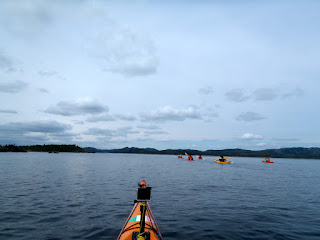
With kayaks heavily loaded with all the necessities for four days we made our way down Fair and False Bay. I don't know how it came by that name; it was fair but nothing false about it.
We handrailed the shore going east for six kilometers until the land stopped our progress. We turned northerly into Long Reach paddling four kilometers to emerge into Morris Channel.
A kilometer further we stopped at Bloody Point where English settlers had a bloody skirmish with aboriginals known as Beothuks. Bloody Point is ...
... protected archaeological site.
The significance of Bloody Point, besides the questionable need for violence, is the presence of a stone quarry. The quarry is the largest aboriginal quarry found on the island of Newfoundland.
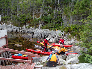
Dale inspects the quarry face that shows signs of the excavation of rhyolite (a volcanic rock) that was used to make arrow heads and stone-age tools. The artifacts from this quarry date back some 5,000 years.
Below the quarry face lay ...
... material not considered suitable. Tailings would be our modern terminology.
Five of us climbed up to the quarry site to have a look. From there we climbed a further 30 meters or so to the top of the hill where we looked down the 100 meters into Bloody Bay Cove where the other four waited patiently for us to return. I launched a rock which fell far short but my shouts reached them to let them know we had reached the "summit".
We had a spectacular view of the sea and islands through which our course for the rest of the day lay. Specifically, the channel between Broad Island on the left and Card Island on the right.
Subscribe to:
Post Comments (Atom)


By throwing a rock from the quarry summit you contributed to destroying the site's archaeological integrity. Also, there is no evidence for a Beothuk-European battle in Bloody Bay Cove. You and your team would have benefited by visiting the Burnside Heritage Foundation Inc. interpretation centre. The BHF discovered the quarry and has conducted all the archaeological research there.
ReplyDeleteI can assure you none of us disturbed anything at the quarry site. The rock I threw was one I picked up laying on the ground on the other side of the hill from the quarry.
ReplyDeleteMaybe not in Bloody Bay Cove, but nearby because Bloody Reach didn't come by its name without some reason.
For your information, the top of Bloody bay Cove is part of the quarry which includes 11 archaeological sites in an 18 hectare area surrounding Bloody Bay Cove. If you moved a rock on top of the hill you caused disturbance. This is why I'm opposed to unaccompanied visits to Bloody bay Cove
ReplyDeleteI’m posting your response so that anyone else who reads this post is aware of the Burnside Heritage Foundation (I’m assuming you represent the Foundation) position on this site.
ReplyDeleteThe sign in the cove indicates “digging, destroying and collecting are illegal”. I don’t believe picking up a rock 100 metres away from the quarry site is any more destructive to the integrity of the site than erecting a platform at the quarry face or the system of stairs to the site. It all depends on the definition of destroying I guess.
Nevertheless, should I visit the site in future, I will be sure not to disturb anything on the hill.
A footnote: The stairs should be repaired or removed as the state of decay looks to be a legal liability for the Foundation.