Translate

Friday, October 14, 2011

Return to civilization

Departing

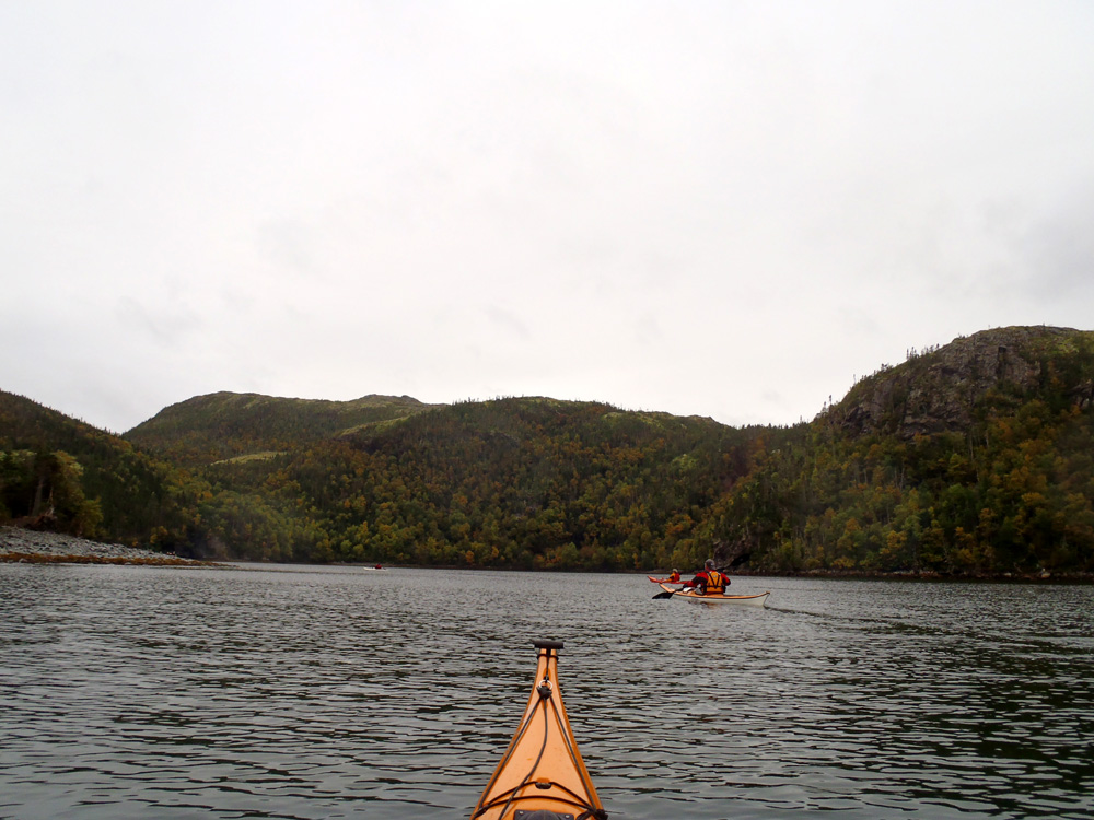
We had hit the hay early Sunday night due to rain. I awoke from a good sleep to see the sun gently bathing the distant hills in warm sunlight. After a couple of days of mixed weather our return home promised to be pleasant.

Sailors beware

Exiting St. Jones Harbour the skyline was aglow in pink light suggesting the weather would change according to the axiom "red sky at night, sailors delight; red sky in the morning, sailors take warning". I wonder if that's taught in Paddle Canada courses *lol*

Exploring

Right after turning north at North Head there was a passageway behind some rocks that, of course, we had to paddle through.

Seal Island

Several kilometers north of St.Jones Without Seal Island came into view silhouetted low against the distant hills.

Looking back

Looking back, we had put some distance between ourselves and St. Jones Island which lies a kilometer off the mainland.

Shafts of light

The sun did its best to break out as shafts of light broke through the clouds behind Brian and Hazen.

Inside channel

The water was calm as Pete an I paddled inside of Seal Island to our right. Up to here we had a gentle quartering sea from the rear starboard.

Approaching Bald Head

Back into quartering seas we approach Bald Head and the last leg of our journey.

Caplin Cove

Finally, the sun came full out two kilometers from the end of our trip. We left in wind and rain on Saturday and had a cloudy day on Sunday but I wouln't have missed it for anything.

And that's that

All good things the say must come to an end. It was a most enjoyable weekend made all the more enjoyable knowing its probably the last opportunity to kayak camp this year.

Thanks Pete for planning the trip and everyone for the excellent company.

Thursday, October 13, 2011

Off to Deer Harbour

Getting in

After a good night sleep, helped by the Irish coffee the night before, we had breakfast, loaded the boats, carried them back down the bank and were ready to go to Deer Harbour.

Destination in sight

Deer Harbour lay 5 kilometers south down the coast of Trinity Bay but first we had to paddle up from the bottom of St. Jones Harbour. The narrow exit of the harbour lay in the distance.

Pastels

The trees were abalze with the pastel colours of fall.

Community

Cabins now occupy part of the resettled community of St. Jones Without. Back in the day when there was a community here, there would have been more houses crowded together hugging the steep hillside a kilometer from the entrance to the harbour. While the harbour is 5 kilometers deep, the fishermen would have wanted to live as close to the entrance as possible because they would have had to row dories out to the fishing grounds.

Deer Harbour, here we come

Leaving St. Jones Without we passed between some rocks at the southern headland before making our way down the coast towards Deer Harbour some 5 kilometers away.

Birch Cove

Approaching Deer Harbour we paddled into Birch Cove and inside of a sizeable, un-named island.

Local knowledge

As we entered Deer Harbour we heard an outboard motorboat who we hailed to get local information about possible camping spots. If push came to shove we were offered the opportunity to camp at this guy's cabin.

Entering Deer Harbour

Deer Harbour extends 9 kilometers inland and is considerably wider than St. Jones Without. We scouted along the north shore of the harbour and stopped at a small cove in Strong Tickle for lunch. We weren't very optimistic about finding a campsite so we more or less swung through paddling around Gooseberry Island and inside of Grub Island before deciding to return to a campsite at St. Jones Without.

We're out of here

Deer Harbour overall was disappointing for me. There were some scenic locations and the sun did come out for a while but the lack of campsites didn't make it very endearing. We grudgingly accepted that any decent campsites would have already been claimed by cabin owners.

Campsite

Just inside of the entrance to St. Jones Without we set up camp on this flat piece of ground.

We could have stayed here the first night but were too deep into the harbour to return before failing light. If I return to this coast I would camp here, bypass Deer Harbour and camp on Bull
Island.

Driftwood

We collected some driftwood for a campfire after dark.

Fire on the beach

I was kept in check with the size of the fire but it was a fine one nonetheless.

Roughing it

Hazen promised us another Irish coffee on the second night and again it hit the spot. This time one of his mugs broke and Pete took his in a regular coffee mug. Either way, it tasted good and proves that just because you're roughing it, you can still enjoy some of the comforts of home.

At 8:30 it started to rain. We called it an early night and retreated to the comfort of our tents. An early night meant we'd get a good rest before heading back to Gooseberry Cove and back to our daily routines the next day. So far so good, almost 50 kms paddled.

Wednesday, October 12, 2011

St. Jones Harbour

Approaching St. Jones Within

We left Gooseberry Cove at 11:00 and after stopping at Round Harbour for a quick lunch we arrived at the entrance to St. Jones Harbour at 2:30.

St. Jones Harbour breadcrumbs

St. Jones Harbour is a fjord-like finger of the sea that pierces the land some five kilometers inland. We knew beforehand that finding a level campsite was going to be difficult.

Having a look

As we entered the harbour we saw what looked like a possible campsite where the cemetery had been. Brian, Pete and I got out to have a look while Hazen chatted it a up with someone who had come by in a motor boat. The site was too wet but Hazen was told there was a nice cabin at the end of the harbour where we could camp.

Autumn colours

We wanted to find our own campsite so we scouted along the shoreline. Things didn't look promising but it sure was pretty paddling down the fjord with fall colours starting to dominate.

Still looking

I anticipated a slog down the harbour into strong funneling winds but it was pleasant going. We could see there were no possible campsites as far as where the fjord pinched in in the distance.

Campsite

We explored the different nooks and crannies at the bottom of the harbour but found only steep hillsides or wet boggy sites. It was getting near 5:00 when we conceded we had to use a developed site. We had to because there wasn't much light left in the day and we had to set up camp. We landed. It took four of us to lift the fully loaded kayaks up a 2 meter embankment onto the level area in front of the cabin.

In the dark

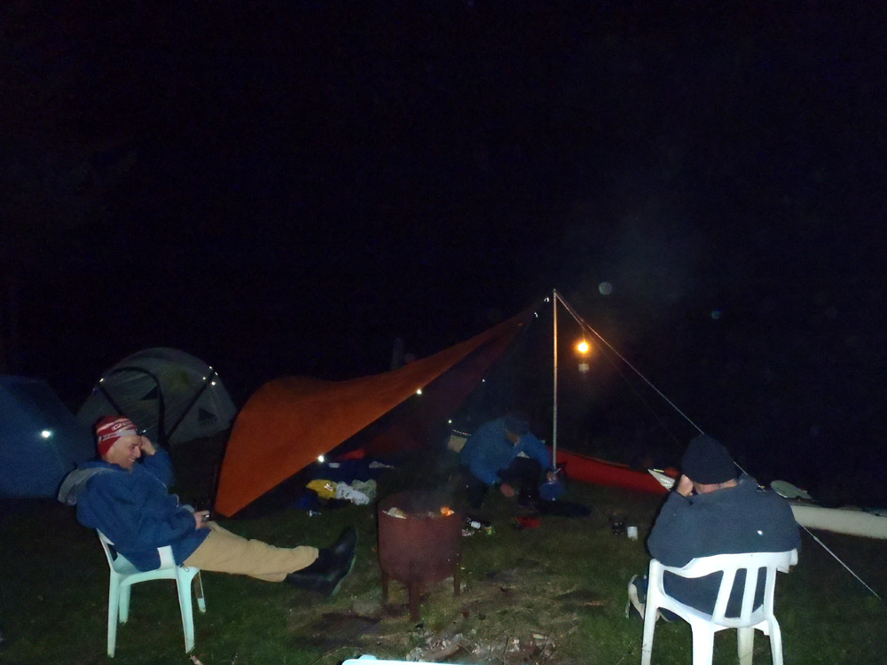
Hazen, Pete and I set up tents while Brian set up the tarp. There wasn't any driftwood around but there was a firepit so we didn't need much wood to have a campfire. We gathered a bit and borrowed a few junks from a pile stacked by the cabin owner. After cooking supper we lit the fire, had a few swallies of the refreshments we brought and shared jokes and tall tales. The deck chairs made for a comfortable evening.

The evening was getting on but we had one more surprise. Unknown to us Hazen had brought supplies for ...

Irish coffee

We were deep in no man's land with no one around for kilometers but that didn't mean we couldn't enjoy the comforts of home. The Irish coffee was the highlight of the evening and the trip so far. Well done Hazen and thanks.

Tuesday, October 11, 2011

St. Jones Without

Loading gear

Peter concocted a kayak camping trip to St Jones Without this past weekend, the Thanksgiving Day long weekend in Canada. Four signed up for the adventure and drove to Gooseberry Cove where we prepared to leave for our paddle south into Trinity Bay.

St Jones Without, named "Without" to distinguish is from the nearby St. Jones (Within) in Southwest Arm. St. Jones Without was settled in 1870 by the Greens of Greens Harbour on the east side of Trinity Bay, 20 kms distant. In 1884 it had 33 residents, peaking in 1935 at 140 residents. In 1951 when it was abandoned there were 81 residents.

Waiting

A bit of wind was blowing down Hearts Ease Tickle so Pete and I sheltered behind some rocks while Brian waited in the Tickle for Hazen.

Ready to go

Hazen put in and he and Brian joined us and we were ready to go.

Down the coast

St. Jones Without is located down an exposed coast accessible only by boat in summer or skidoo in winter.

Into the wind

We were promised showers and some wind but it was a bit more than I expected. We were undeterred, simply digging in a bit in the gusts.

Ducking behind

Occasionally rocks provided a little bit of shelter and respite.

Rugged coastline

The rocks along the coast here are part of the Bull Arm Formation consisting of mainly andesitic volcanic flows, breccias and tuffs with sedimentary rocks. In other words, this land was formed by volcanoes shedding sediment into the surrounding seas. Probably not unlike parts southeast Asia today.

Round Harbour

We left Gooseberry Cove at 11:00. An hour and a half later we were ready for lunch and the very sheltered Round Harbour provided the ideal place to stop.

Lunch stop

The only decent place to take out was occupied by a cabin. A table and chairs was provided on the veranda so we took advantage of that but not for long. It didn't take long to cool down and we were soon back in our boats and on our way south.

Seal Island shelter

Passing by St. Jones Head, again in a bit of blustery wind, we paddled inside of Seal Island were it was peacefully calm.

Outside of St. Jones Without

At just after 2:00, under grey skies, we reached the entrance to St. Jones Harbour, a fjord like arm of the sea reaching 5 kilometers inland. The narrow entrance beckons right in front of my bow.

Friday, October 7, 2011

Birds' eye view

Lower end of Trinity Bay

I like to print maps of the coastlines I paddle. So do a lot of people I paddle with.

The maps I usually print are 1:20,000 for the greatest detail. There's a lot of detail but I've found I'm losing the bigger picture. I've found myself sometimes looking outside of the map boundaries wondering it some far away cape is such and such.

This weekend a group of us are kayak camping in the St. Jones Without/Deer Harbour area. I've decided to print with less detail (1:200,000) that includes the whole bay. It will give me a better overview of everything around me.

Sometimes the devil is in the detail and sometimes its not.

Wednesday, October 5, 2011

Greenland paddle, Tony's take

A Greenland paddle devotee

More people are using Greenland paddles. I wonder why. Is it better technology than what western technology has come up with?

I think it might be more a question of resources than an end product of trial and error.

I recently purchased a book entitled "Lands Forlorn" by George M. Douglas about a 1912 copper exploration expedition to the Coppermine region in Canada's north. There the party came in contact with Inuit and a picture on page 224 shows a kayak frame with an Inuit hunter holding a doubled, wide bladed paddle.

Th Arctic Ocean flows out through the channel between Baffin Island and Greenland. There wouldn't have been much wood drifting north from forested areas. What wood did wash up on Greenland beaches would in all likelihood have been small sticks. Would the Greenland Inuit have had to make that wood work to fashion a paddle?

Could the wide blade of Coppermine Inuit have been due to access to wider sticks of wood? They did frequent treeline country to hunt cariboo.

I don't know.

I'm happy with my Euro blade and I think I'll stick (pardon the pun) with it.

Sunday, October 2, 2011

Centennial paddle

It is what it is

The weather was crappy but I got out anyway. I had to. It was my 100th time in the kayak this year. I think it was around Dean's 80th. He'd also have 100 if he didn't have a day job. My lucky!